|
search place name
|
||
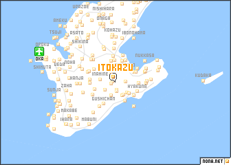
Itokazu (Okinawa, Japan)Itokazu is a town in the Okinawa region of Japan. An overview map of the region around Itokazu is displayed below.
regional and 3d topo map of Itokazu, Japan ::
Itokazu airports ::
The nearest airport is OKA - Naha, located 12.1 km north west of Itokazu.
Other airports nearby include DNA - Kadena Ab (22.6 km north), UEO - Kumejima (106.8 km west), RNJ - Yoron (117.9 km north east), TKN - Tokunoshima (217.5 km north east), Nearby towns ::
Funakushi (0.4km west) //
Ōgusuku (0.7km west) //
Fusato (1.3km south) //
Tōyama (1.5km south) //
Kirabaru (1.6km east) //
Karadera (1.8km north) //
Maekawa (1.9km south west) //
Okoku (2.1km north) //
Aragusuku (2.2km south) //
Minatogawa (2.3km south east) //
Shikenbaru (2.3km south east) //
Inamine (2.2km west) //
Shinzato (2.4km north east) //
Nakayama (2.4km south east) //
Taira (2.8km north) //
Tamagusuku (2.7km south east) //
Nakama (3.1km north west) //
Ō (3.3km south east) //
Kochima (3.1km north east) //
Koshihara (3.2km west) //
Nakahodo (3.5km north) //
Nishihara (3.6km north) //
Kachabaru (3.4km south east) //
Ōsato (3.6km north) //
Sashiki (3.4km north east) //
Kakinohana (3.4km east) //
Hyakuna (3.6km south east) //
Tsuhako (3.8km north) //
Gushichan (3.9km south west) //
[all distances 'as the bird flies' and approximate]  Places with similar names to Itokazu, Japan ::
Disclaimer :: Information on this page comes without warranty of any kind |
||
|
Where is Itokazu? Elevation and coordinates ::
Latitude (lat): 26°9'7"N Longitude (lon): 127°45'23"E
Elevation (approx.): 73m (map arrows pan, magnifying glasses zoom) |
||
|
Visiting Itokazu? Hotel/Accommodation ::
Book a hotel in Itokazu Travel Guide ::
Buy a travel guide for Japan rental cars ::
car rental offers GPS waypoint ::
download a GPX waypoint (PoI) of Itokazu for your GPS receiver
|
||