|
search place name
|
||
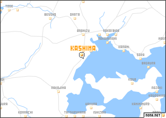
Kashima (Ishikawa, Japan)Kashima is a town in the Ishikawa region of Japan. An overview map of the region around Kashima is displayed below.
regional and 3d topo map of Kashima, Japan ::
Kashima airports ::
The nearest airport is TOY - Toyama, located 64.7 km south east of Kashima.
Other airports nearby include KMQ - Kanazawa Komatsu (98.0 km south west), MMJ - Matsumoto (145.2 km south east), Nearby towns ::
Shigaura (1.9km north) //
Ninzaki (2.4km north east) //
Anamizu (5.6km north) //
Mugigaura (6.3km north east) //
Iwaguruma (5.8km north east) //
Nakai-minami (5.8km north east) //
Nakai (7.1km north east) //
Nakajima (8.6km south west) //
Bira (8.1km north east) //
[all distances 'as the bird flies' and approximate] 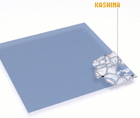 Places with similar names to Kashima, Japan ::
Disclaimer :: Information on this page comes without warranty of any kind |
||
|
Where is Kashima? Elevation and coordinates ::
Latitude (lat): 37°11'0"N Longitude (lon): 136°54'0"E
Elevation (approx.): 3m (map arrows pan, magnifying glasses zoom) |
||
|
Visiting Kashima? Hotel/Accommodation ::
Book a hotel in Kashima Travel Guide ::
Buy a travel guide for Japan rental cars ::
car rental offers GPS waypoint ::
download a GPX waypoint (PoI) of Kashima for your GPS receiver
|
||