|
search place name
|
||
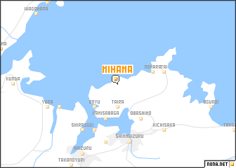
Mihama (Kyōto, Japan)Mihama is a town in the Kyōto region of Japan. An overview map of the region around Mihama is displayed below.
regional and 3d topo map of Mihama, Japan ::
Mihama airports ::
The nearest airport is ITM - Osaka Intl, located 85.0 km south of Mihama.
Other airports nearby include TTJ - Tottori (110.4 km west), KMQ - Kanazawa Komatsu (131.5 km north east), OKJ - Okayama (164.7 km south west), TKS - Tokushima (172.5 km south west), Nearby towns ::
Taira (3.7km south) //
Nakata (3.7km south) //
Ōnyū (4.8km south west) //
Kami-sabaga (5.8km south) //
Nohara (4.9km east) //
Ōba-kami (6.3km south east) //
Ōba-shimo (6.3km south east) //
Tai (6.3km east) //
Itsumori (8.0km south) //
Shirasugi (8.7km south west) //
Kichisaka (9.6km south east) //
[all distances 'as the bird flies' and approximate] 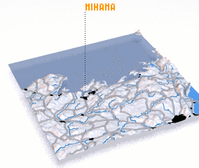 Places with similar names to Mihama, Japan ::
Disclaimer :: Information on this page comes without warranty of any kind |
||
|
Where is Mihama? Elevation and coordinates ::
Latitude (lat): 35°33'0"N Longitude (lon): 135°23'0"E
Elevation (approx.): 325m (map arrows pan, magnifying glasses zoom) |
||
|
Visiting Mihama? Hotel/Accommodation ::
Book a hotel in Mihama Travel Guide ::
Buy a travel guide for Japan rental cars ::
car rental offers GPS waypoint ::
download a GPX waypoint (PoI) of Mihama for your GPS receiver
|
||