|
search place name
|
||
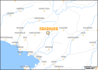
Nakamura (Wakayama, Japan)Nakamura is a town in the Wakayama region of Japan. An overview map of the region around Nakamura is displayed below.
regional and 3d topo map of Nakamura, Japan ::
Nakamura airports ::
The nearest airport is SHM - Nanki-shirahama Nanki Shirahama, located 16.6 km south west of Nakamura.
Other airports nearby include TKS - Tokushima (84.9 km north west), ITM - Osaka Intl (109.3 km north), TAK - Takamatsu (138.8 km west), KCZ - Kochi (166.0 km west), Nearby towns ::
 Places with similar names to Nakamura, Japan ::
// Neukammer (DE)
// New Cambria (US)
// Negomiru (RO)
// Nukumaru (NZ)
// New Cambria (US)
// Newcomer (US)
// Newcomer (US)
// Nakomoro (BF)
// Nakoumbourou (BF)
// Nkomera (BI)
Disclaimer :: Information on this page comes without warranty of any kind |
||
|
Where is Nakamura? Elevation and coordinates ::
Latitude (lat): 33°48'0"N Longitude (lon): 135°26'0"E
Elevation (approx.): 250m (map arrows pan, magnifying glasses zoom) |
||
|
Visiting Nakamura? Hotel/Accommodation ::
Book a hotel in Nakamura Travel Guide ::
Buy a travel guide for Japan rental cars ::
car rental offers GPS waypoint ::
download a GPX waypoint (PoI) of Nakamura for your GPS receiver
|
||