|
search place name
|
||
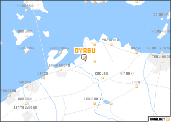
Ōyabu (Kagawa, Japan)Ōyabu is a town in the Kagawa region of Japan. An overview map of the region around Ōyabu is displayed below.
regional and 3d topo map of Ōyabu, Japan ::
Ōyabu airports ::
The nearest airport is TAK - Takamatsu, located 17.0 km south east of Ōyabu.
Other airports nearby include OKJ - Okayama (47.2 km north), TKS - Tokushima (68.8 km east), KCZ - Kochi (89.9 km south), HIJ - Hiroshima (90.9 km west), Nearby towns ::
Takaya (1.5km east) //
Ichimonji (3.6km south west) //
Higashibun (4.0km north) //
Kokubu (4.8km south east) //
Sakaide (5.0km west) //
Sakaidechō (5.0km west) //
Takenoura (5.0km west) //
Yuzuriha (5.9km north east) //
[all distances 'as the bird flies' and approximate] 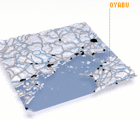 Places with similar names to Ōyabu, Japan ::
Disclaimer :: Information on this page comes without warranty of any kind |
||
|
Where is Ōyabu? Elevation and coordinates ::
Latitude (lat): 34°20'0"N Longitude (lon): 133°54'0"E
Elevation (approx.): 81m (map arrows pan, magnifying glasses zoom) |
||
|
Visiting Ōyabu? Hotel/Accommodation ::
Book a hotel in Ōyabu Travel Guide ::
Buy a travel guide for Japan rental cars ::
car rental offers GPS waypoint ::
download a GPX waypoint (PoI) of Ōyabu for your GPS receiver
|
||