|
search place name
|
||
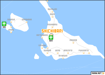
Shichibari (Okinawa, Japan)Shichibari is a town in the Okinawa region of Japan. An overview map of the region around Shichibari is displayed below.
regional and 3d topo map of Shichibari, Japan ::
Shichibari airports ::
The nearest airport is MMY - Miyako, located 0.5 km west of Shichibari.
Other airports nearby include SHI - Shimojishima (16.4 km west), ISG - Ishigaki (122.8 km south west), UEO - Kumejima (225.4 km north east), Nearby towns ::
Nanseien (2.5km north west) //
Hirara (2.5km north west) //
Matsubara (3.4km west) //
Nishibaru (3.7km north) //
Uechi (4.1km south west) //
Yonaha (5.0km south west) //
Sukama (5.8km south) //
Ueno (5.8km south) //
Ōura (7.4km north) //
Nagama (7.0km east) //
Hika (7.0km east) //
Arazato (7.5km south east) //
Miyakuni (8.1km south east) //
[all distances 'as the bird flies' and approximate] 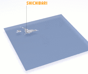 Places with similar names to Shichibari, Japan ::
Disclaimer :: Information on this page comes without warranty of any kind |
||
|
Where is Shichibari? Elevation and coordinates ::
Latitude (lat): 24°47'0"N Longitude (lon): 125°18'0"E
Elevation (approx.): 50m (map arrows pan, magnifying glasses zoom) |
||
|
Visiting Shichibari? Hotel/Accommodation ::
Book a hotel in Shichibari Travel Guide ::
Buy a travel guide for Japan rental cars ::
car rental offers GPS waypoint ::
download a GPX waypoint (PoI) of Shichibari for your GPS receiver
|
||