|
search place name
|
||
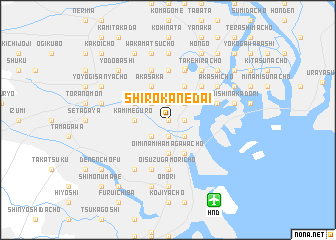
Shirokanedai (Tōkyō, Japan)Shirokanedai is a town in the Tōkyō region of Japan. An overview map of the region around Shirokanedai is displayed below.
regional and 3d topo map of Shirokanedai, Japan ::
nearby GPS traces from timatio ::
Shirokanedai airports ::
The nearest airport is HND - Tokyo Intl, located 9.9 km south east of Shirokanedai.
Other airports nearby include OKO - Yokota Ab (37.1 km west), NRT - Tokyo Narita Intl (60.9 km east), OIM - Oshima (100.4 km south), MMY - Miyake Jima Miyakejima (173.8 km south), Nearby towns ::
Shiba-Takahamachō (0.0km north) //
Takanawa (0.0km north) //
Shirokane (0.0km north) //
Higashi-ōsaki (1.9km south) //
Nishi-shibaura (1.5km east) //
Shiba-Kaigandōri (1.5km east) //
Azabu-Fujimichō (1.9km north) //
Roppongi (1.9km north) //
Mita (1.9km north) //
Shibaura (1.5km east) //
Gotanda (2.4km south west) //
Shimo-meguro (2.4km south west) //
Tennōsuchō (2.4km south east) //
Minami-aoyama (2.4km north west) //
Shiba-Kanasugihamachō (2.4km north east) //
Shiba-Shimbashi (2.4km north east) //
Shiba (2.4km north east) //
Shiba-Shimborichō (2.4km north east) //
Shiba-Hamamatsuchō (2.4km north east) //
Higashi-shinagawa (3.7km south) //
Minami-shinagawa (3.7km south) //
Ōi-Minamihamagawachō (3.7km south) //
Nishi-shinagawa (3.7km south) //
Kami-meguro (3.0km west) //
Ōi-Kitahamagawachō (4.0km south) //
Kachijimachō (4.0km south) //
Sarugakuchō (3.5km north west) //
Akasaka (4.0km north) //
Kasumigaseki (4.0km north) //
[all distances 'as the bird flies' and approximate] 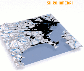 Places with similar names to Shirokanedai, Japan ::
// Shurakend (AZ)
// Chīr Kandī (IR)
// Chairākānda (BD)
// Char Kānāidia (BD)
// Charkāndi (BD)
// Chārua Kāndi (BD)
// Shāriākāndi (BD)
// Tiarkāndi (BD)
// Tiarkouandé (BJ)
// Chārakunda (IN)
Disclaimer :: Information on this page comes without warranty of any kind |
||
|
Where is Shirokanedai? Elevation and coordinates ::
Latitude (lat): 35°38'0"N Longitude (lon): 139°44'0"E
Elevation (approx.): 15m (map arrows pan, magnifying glasses zoom) |
||
|
Visiting Shirokanedai? Hotel/Accommodation ::
Book a hotel in Shirokanedai Travel Guide ::
Buy a travel guide for Japan rental cars ::
car rental offers GPS waypoint ::
download a GPX waypoint (PoI) of Shirokanedai for your GPS receiver
|
||