|
search place name
|
||
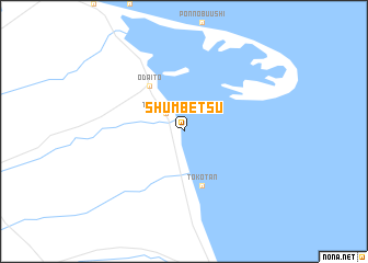
Shumbetsu (Hokkaidō, Japan)Shumbetsu is a town in the Hokkaidō region of Japan. An overview map of the region around Shumbetsu is displayed below.
regional and 3d topo map of Shumbetsu, Japan ::
Shumbetsu airports ::
The nearest airport is SHB - Nakashibetsu, located 24.4 km west of Shumbetsu.
Other airports nearby include MMB - Memanbetsu (96.4 km north west), MBE - Monbetsu (172.2 km north west), Nearby towns ::
To-shumbetsu (2.3km north west) //
Odaitō (5.3km north west) //
Tokotan (5.7km south) //
[all distances 'as the bird flies' and approximate] 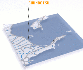 Places with similar names to Shumbetsu, Japan ::
// Shumbāţis (EG)
// Shembetsay (KZ)
// Hsia-ma-ts'o (TW)
// Chomutice (CZ)
// Shimotsui (JP)
// Chiembetsu (JP)
// Shimotsu (JP)
// Shumbetsu (JP)
// Chamboutes (FR)
// Chaumots (FR)
Disclaimer :: Information on this page comes without warranty of any kind |
||
|
Where is Shumbetsu? Elevation and coordinates ::
Latitude (lat): 43°31'0"N Longitude (lon): 145°15'0"E
Elevation (approx.): -32768m (map arrows pan, magnifying glasses zoom) |
||
|
Visiting Shumbetsu? Hotel/Accommodation ::
Book a hotel in Shumbetsu Travel Guide ::
Buy a travel guide for Japan rental cars ::
car rental offers GPS waypoint ::
download a GPX waypoint (PoI) of Shumbetsu for your GPS receiver
|
||