|
search place name
|
||
Tamashima (Saga, Japan)Tamashima is a town in the Saga region of Japan. An overview map of the region around Tamashima is displayed below.
regional and 3d topo map of Tamashima, Japan ::

Tamashima airports ::
The nearest airport is FUK - Fukuoka, located 39.4 km north east of Tamashima.
Other airports nearby include IKI - Iki (43.5 km north west), NGS - Nagasaki (59.3 km south), KMJ - Kumamoto (99.1 km south east), KKJ - New Kitakyushu (100.7 km north east), Nearby towns ::
Gotanda (0.2km north east) //
Okaguchi (0.9km north west) //
Taniguchi (1.8km north west) //
Yokota (2.3km west) //
Hamasaki (2.5km west) //
Fuchinoue (2.9km north west) //
Hisubaru (3.0km west) //
Tarukado (3.6km east) //
Tani (4.5km north) //
Sunago (4.3km west) //
Shikaka (5.4km north) //
Nijinomatsubara (5.6km west) //
Kagami (5.7km west) //
Torisu (6.1km south east) //
Tanaka (5.8km west) //
Fukuihama (7.3km north) //
Dainyū (8.3km north east) //
Sanami (8.3km north east) //
Yodogawa (10.0km north east) //
Fukae (10.3km north east) //
[all distances 'as the bird flies' and approximate] 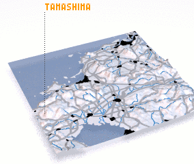 Places with similar names to Tamashima, Japan ::
Disclaimer :: Information on this page comes without warranty of any kind |
||
|
Where is Tamashima? Elevation and coordinates ::
Latitude (lat): 33°26'9"N Longitude (lon): 130°4'0"E
Elevation (approx.): 28m (map arrows pan, magnifying glasses zoom) |
||
|
Visiting Tamashima? Hotel/Accommodation ::
Book a hotel in Tamashima Travel Guide ::
Buy a travel guide for Japan rental cars ::
car rental offers GPS waypoint ::
download a GPX waypoint (PoI) of Tamashima for your GPS receiver
|
||