|
search place name
|
||
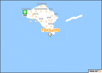
Tokujimo (Okinawa, Japan)Tokujimo is a town in the Okinawa region of Japan. An overview map of the region around Tokujimo is displayed below.
regional and 3d topo map of Tokujimo, Japan ::
Tokujimo airports ::
The nearest airport is UEO - Kumejima, located 12.4 km north west of Tokujimo.
Other airports nearby include OKA - Naha (85.1 km east), DNA - Kadena Ab (96.9 km east), RNJ - Yoron (180.3 km north east), MMY - Miyako (224.7 km south west), Nearby towns ::
Shimajiri (2.4km north) //
Zenda (3.7km north) //
Magari (3.7km north) //
Yamagusuku (4.1km north west) //
Janadō (5.6km north) //
Kami-hika (5.8km north) //
Higa (6.1km north) //
Unedomari (6.2km north) //
Kadekaru (6.5km north west) //
Gima (6.5km north west) //
Une (7.6km north) //
Madomai (7.6km north) //
Maja (7.7km north) //
Ōta (7.5km north west) //
Kanegusuku (7.9km north west) //
Torishima (8.7km north west) //
Uezu (8.9km north west) //
Nakadomari (8.8km north west) //
Nishime (9.9km north west) //
Nakachi (10.3km north west) //
[all distances 'as the bird flies' and approximate] 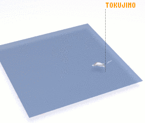 Places with similar names to Tokujimo, Japan ::
Disclaimer :: Information on this page comes without warranty of any kind |
||
|
Where is Tokujimo? Elevation and coordinates ::
Latitude (lat): 26°17'0"N Longitude (lon): 126°48'0"E
Elevation (approx.): -32768m (map arrows pan, magnifying glasses zoom) |
||
|
Visiting Tokujimo? Hotel/Accommodation ::
Book a hotel in Tokujimo Travel Guide ::
Buy a travel guide for Japan rental cars ::
car rental offers GPS waypoint ::
download a GPX waypoint (PoI) of Tokujimo for your GPS receiver
|
||