|
search place name
|
||
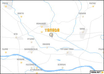
Yanada (Tochigi, Japan)Yanada is a town in the Tochigi region of Japan. An overview map of the region around Yanada is displayed below.
regional and 3d topo map of Yanada, Japan ::
Yanada airports ::
The nearest airport is OKO - Yokota Ab, located 62.4 km south of Yanada.
Other airports nearby include HND - Tokyo Intl (87.2 km south), NRT - Tokyo Narita Intl (100.8 km south east), MMJ - Matsumoto (141.1 km west), OIM - Oshima (168.8 km south), Nearby towns ::
Nakano (4.0km south) //
Fukui (3.5km north west) //
Ashikaga (4.8km north west) //
Ryūmai (6.3km west) //
Tatebayashi (7.1km south east) //
Shimo-koizumi (8.2km south west) //
Kami-koizumi (8.2km south west) //
[all distances 'as the bird flies' and approximate] 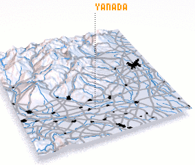 Places with similar names to Yanada, Japan ::
Disclaimer :: Information on this page comes without warranty of any kind |
||
|
Where is Yanada? Elevation and coordinates ::
Latitude (lat): 36°18'0"N Longitude (lon): 139°29'0"E
Elevation (approx.): 27m (map arrows pan, magnifying glasses zoom) |
||
|
Visiting Yanada? Hotel/Accommodation ::
Book a hotel in Yanada Travel Guide ::
Buy a travel guide for Japan rental cars ::
car rental offers GPS waypoint ::
download a GPX waypoint (PoI) of Yanada for your GPS receiver
|
||