|
search place name
|
||
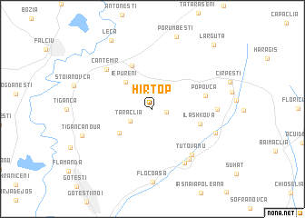
Hîrtop (Raionul )) (( Anenii Noi, Moldova)Hîrtop is a town in the Raionul )) (( Anenii Noi region of Moldova. An overview map of the region around Hîrtop is displayed below.
regional and 3d topo map of Hîrtop, Moldova ::
Hîrtop airports ::
The nearest airport is KIV - Kichinau Fir/acc/com Chisinau Intl, located 93.1 km north east of Hîrtop.
Other airports nearby include BCM - Bacau (108.0 km west), IAS - Iasi (115.5 km north west), TCE - Tulcea Cataloi (135.1 km south), CND - Constanta Mihail Kogalniceanu (208.8 km south), Nearby towns ::
Alexandrovca (1.3km east) //
Taraclia (2.4km south west) //
Iepureni (4.0km north west) //
Plopi (4.1km south west) //
Cania (5.6km north) //
(( Ilashkova )) (4.4km south east) //
Popovca (4.8km east) //
(( Tutovanu )) (6.6km south east) //
Cantemir (6.3km north west) //
(( Victoria )) (6.9km south east) //
Ciobalaccia (7.2km south east) //
Lingura (5.5km east) //
Tartaul (6.2km south east) //
Ţiganca Nouă (6.8km south west) //
Porumbeşti (9.1km north) //
Leca (9.1km north west) //
Lărguţa (9.5km north east) //
[all distances 'as the bird flies' and approximate] 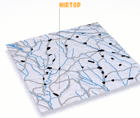 Places with similar names to Hîrtop, Moldova ::
Disclaimer :: Information on this page comes without warranty of any kind |
||
|
Where is Hîrtop? Elevation and coordinates ::
Latitude (lat): 46°14'2"N Longitude (lon): 28°15'4"E
Elevation (approx.): 74m (map arrows pan, magnifying glasses zoom) |
||
|
Visiting Hîrtop? Hotel/Accommodation ::
Book a hotel in Hîrtop Travel Guide ::
Buy a travel guide for Moldova rental cars ::
car rental offers GPS waypoint ::
download a GPX waypoint (PoI) of Hîrtop for your GPS receiver
|
||