|
search place name
|
||
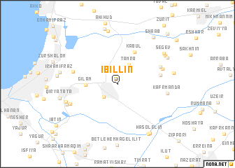
I‘billīn (HaẔafon, Israel)I‘billīn is a town in the HaẔafon region of Israel. An overview map of the region around I‘billīn is displayed below.
regional and 3d topo map of I‘billīn, Israel ::
I‘billīn airports ::
The nearest airport is HFA - Haifa, located 13.7 km west of I‘billīn.
Other airports nearby include RPN - Rosh Pina Mahanaim I Ben Yaakov (40.0 km north east), SDV - Tel-aviv Sde Dov (87.1 km south west), TLV - Tel-aviv Ben Gurion (94.1 km south), OMF - Mafraq King Hussein (112.9 km south east), Nearby towns ::
Shefar‘am (2.7km south west) //
Tamra (3.4km north east) //
Gil‘am (4.3km west) //
Kābūl (5.6km north east) //
Kaukab Abū el Hīja (5.9km east) //
Shekhanya (6.4km north east) //
Afeq (6.4km west) //
Qoranit (6.4km north east) //
Kafr Mandā (6.8km east) //
Ramat Yaẖanan (7.1km south west) //
Yavor (8.6km north) //
Kefar HaMaccabi (7.5km south west) //
Usha (7.5km west) //
Misgav (7.8km north east) //
Segev (7.9km north east) //
Raqqefet (7.8km north east) //
Yas‘ur (9.0km north) //
Bīr el Maksūr (8.9km south east) //
HaSolelim (8.9km south east) //
Sha‘ab (8.9km north east) //
Shorashim (10.4km north east) //
[all distances 'as the bird flies' and approximate] 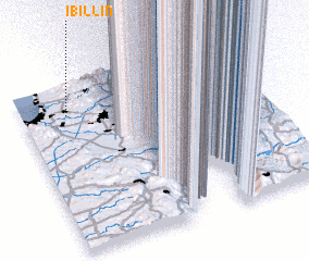 Places with similar names to I‘billīn, Israel ::
Disclaimer :: Information on this page comes without warranty of any kind |
||
|
Where is I‘billīn? Elevation and coordinates ::
Latitude (lat): 32°49'14"N Longitude (lon): 35°11'21"E
Elevation (approx.): 102m (map arrows pan, magnifying glasses zoom) |
||
|
Visiting I‘billīn? Hotel/Accommodation ::
Book a hotel in I‘billīn Travel Guide ::
Buy a travel guide for Israel rental cars ::
car rental offers GPS waypoint ::
download a GPX waypoint (PoI) of I‘billīn for your GPS receiver
|
||