|
search place name
|
||
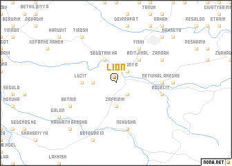
Li On (Yerushalayim, Israel)Li On is a town in the Yerushalayim region of Israel. An overview map of the region around Li On is displayed below.
regional and 3d topo map of Li On, Israel ::
Li On airports ::
The nearest airport is TLV - Tel-aviv Ben Gurion, located 36.6 km north of Li On.
Other airports nearby include BEV - Beer-sheba Teyman (48.3 km south west), SDV - Tel-aviv Sde Dov (49.9 km north), AMM - Amman Queen Alia Intl (100.6 km east), ADJ - Amman Marka Intl (105.2 km east), Nearby towns ::
Giv‘at Yesha‘yahu (2.4km south east) //
Zekharya (2.4km north east) //
‘Agur (3.2km west) //
Massuʼa (3.2km west) //
Ẕafririm (3.7km south) //
Sedot Mikha (4.0km north west) //
Beit Jimāl (4.9km north east) //
Luzit (4.7km west) //
Yish‘i (6.4km north east) //
Netiv HaLamed He (6.3km east) //
Neẖusha (7.6km south) //
Adderet (6.6km east) //
Newe Mikhaʼel (6.6km east) //
Rogelit (6.6km east) //
Bet Nir (7.3km south west) //
Zanoaẖ (7.3km north east) //
Gefen (8.8km north west) //
Tirosh (8.8km north west) //
H̱awwat Maresha (9.7km south west) //
Bet Shemesh (9.7km north east) //
[all distances 'as the bird flies' and approximate]  Places with similar names to Li On, Israel ::
Disclaimer :: Information on this page comes without warranty of any kind |
||
|
Where is Li On? Elevation and coordinates ::
Latitude (lat): 31°41'0"N Longitude (lon): 34°56'0"E
Elevation (approx.): 343m (map arrows pan, magnifying glasses zoom) |
||
|
Visiting Li On? Hotel/Accommodation ::
Book a hotel in Li On Travel Guide ::
Buy a travel guide for Israel rental cars ::
car rental offers GPS waypoint ::
download a GPX waypoint (PoI) of Li On for your GPS receiver
|
||