|
search place name
|
||
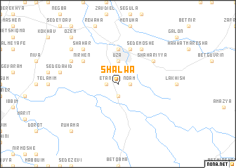
Shalwa (HaDarom, Israel)Shalwa is a town in the HaDarom region of Israel. An overview map of the region around Shalwa is displayed below.
regional and 3d topo map of Shalwa, Israel ::
Shalwa airports ::
The nearest airport is BEV - Beer-sheba Teyman, located 31.3 km south of Shalwa.
Other airports nearby include TLV - Tel-aviv Ben Gurion (50.6 km north), SDV - Tel-aviv Sde Dov (60.8 km north), AMM - Amman Queen Alia Intl (117.6 km east), ADJ - Amman Marka Intl (124.5 km east), Nearby towns ::
No‘am (1.6km east) //
Even Shemuʼel (1.9km north) //
Aẖuzzam (1.9km south) //
Etan (1.6km west) //
Shaʼanan (2.4km north west) //
‘Uza (3.7km north) //
Qiryat Gat (3.7km north) //
Mivhor (5.6km north) //
Gat (5.8km north) //
Sede Moshe (6.4km north east) //
Shaẖariyya (6.0km north east) //
Nir H̱en (6.0km north west) //
Shaẖar (7.3km north west) //
Zohar (7.3km north west) //
Nehora (8.4km north west) //
Nogah (8.4km north west) //
‘Oẕem (9.7km north west) //
Ruẖama (9.7km south west) //
[all distances 'as the bird flies' and approximate] 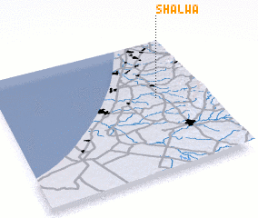 Places with similar names to Shalwa, Israel ::
Disclaimer :: Information on this page comes without warranty of any kind |
||
|
Where is Shalwa? Elevation and coordinates ::
Latitude (lat): 31°34'0"N Longitude (lon): 34°46'0"E
Elevation (approx.): 168m (map arrows pan, magnifying glasses zoom) |
||
|
Visiting Shalwa? Hotel/Accommodation ::
Book a hotel in Shalwa Travel Guide ::
Buy a travel guide for Israel rental cars ::
car rental offers GPS waypoint ::
download a GPX waypoint (PoI) of Shalwa for your GPS receiver
|
||