|
search place name
|
||
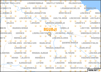
Aguají (Puerto Plata, Dominican Republic)Aguají is a town in the Puerto Plata region of Dominican Republic. An overview map of the region around Aguají is displayed below.
regional and 3d topo map of Aguají, Dominican Republic ::
Aguají airports ::
The nearest airport is POP - Puerto Plata Gregorio Luperon Intl, located 34.6 km east of Aguají.
Other airports nearby include STI - Santiago Cibao Intl (49.1 km south east), CAP - Cap Haitien Intl (135.7 km west), BRX - Barahona Maria Montez Intl (167.5 km south), SDQ - Santo Domingo Las Americas Intl (195.3 km south east), Nearby towns ::
Los Cayucos (0.0km north) //
El Alto de Los Calvos (1.7km west) //
La Frontera (1.7km west) //
El Hoyazo (1.7km west) //
El Alto de las Canas (1.7km west) //
El Mango (1.9km south) //
El Gato (1.9km south) //
Cabía (1.7km east) //
Pozo Prieto (1.7km east) //
Monte Gordo (2.5km south west) //
La Mariposa (2.5km south west) //
Arroyo Viejito (2.5km south west) //
La Lima (2.5km north east) //
El Higüero (3.5km west) //
Caonao (3.5km west) //
Los Palmaritos (3.5km west) //
Rancho Viejo (3.7km south) //
Palo de Guerra (3.7km south) //
Angostura (3.7km north) //
Las Piraguas (3.7km south) //
La Cabirma (3.5km east) //
Rincón Arriba (4.1km south west) //
Guananico (4.1km south west) //
Rincón Caliente (4.1km south west) //
La Boca de Cabía (4.1km north west) //
Agua Larga (4.1km south west) //
El Ranchito de los Peralta (4.0km north west) //
Las Piraguas (4.1km north east) //
Las Piraguas Abajo (4.1km north east) //
[all distances 'as the bird flies' and approximate] 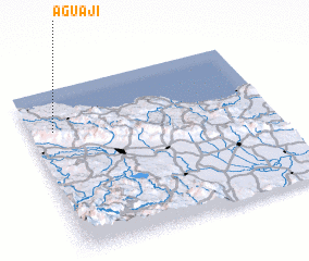 Places with similar names to Aguají, Dominican Republic ::
Disclaimer :: Information on this page comes without warranty of any kind |
||
|
Where is Aguají? Elevation and coordinates ::
Latitude (lat): 19°45'0"N Longitude (lon): 70°54'0"W
Elevation (approx.): 141m (map arrows pan, magnifying glasses zoom) |
||
|
Visiting Aguají? Hotel/Accommodation ::
Book a hotel in Aguají Travel Guide ::
rental cars ::
car rental offers GPS waypoint ::
download a GPX waypoint (PoI) of Aguají for your GPS receiver
|
||