|
search place name
|
||
Cachón Flaco (Independencia, Dominican Republic)Cachón Flaco is a town in the Independencia region of Dominican Republic. An overview map of the region around Cachón Flaco is displayed below.
regional and 3d topo map of Cachón Flaco, Dominican Republic ::

Cachón Flaco airports ::
The nearest airport is BRX - Barahona Maria Montez Intl, located 33.0 km south east of Cachón Flaco.
Other airports nearby include PAP - Port-au-prince Toussaint Louverture Intl (96.7 km west), STI - Santiago Cibao Intl (140.8 km north east), CAP - Cap Haitien Intl (171.2 km north west), POP - Puerto Plata Gregorio Luperon Intl (175.4 km north east), Nearby towns ::
Cachón Claro (1.8km west) //
Charco Largo (2.6km south west) //
Mella (2.6km south west) //
Yeso (4.1km south west) //
Los Pasos (4.1km south west) //
Colonia Mixta de Duvergé (5.6km west) //
El Abanico (5.6km west) //
Batey Nuevo (5.6km east) //
Charabuscal (8.2km south west) //
Bermesí (8.2km south west) //
Cambronal (9.1km north east) //
La Malagueta (10.2km south west) //
[all distances 'as the bird flies' and approximate] 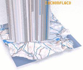 Places with similar names to Cachón Flaco, Dominican Republic :: Disclaimer :: Information on this page comes without warranty of any kind |
||
|
Where is Cachón Flaco? Elevation and coordinates ::
Latitude (lat): 18°23'0"N Longitude (lon): 71°24'0"W
Elevation (approx.): -1m (map arrows pan, magnifying glasses zoom) |
||
|
Visiting Cachón Flaco? Hotel/Accommodation ::
Book a hotel in Cachón Flaco Travel Guide ::
rental cars ::
car rental offers GPS waypoint ::
download a GPX waypoint (PoI) of Cachón Flaco for your GPS receiver
|
||