|
search place name
|
||
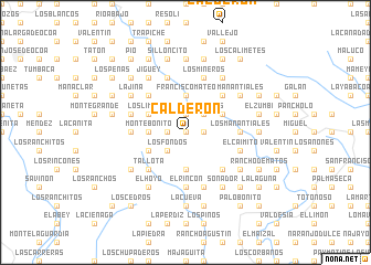
Calderón (Peravia, Dominican Republic)Calderón is a town in the Peravia region of Dominican Republic. An overview map of the region around Calderón is displayed below.
regional and 3d topo map of Calderón, Dominican Republic ::
Calderón airports ::
The nearest airport is SDQ - Santo Domingo Las Americas Intl, located 72.2 km east of Calderón.
Other airports nearby include BRX - Barahona Maria Montez Intl (85.4 km west), STI - Santiago Cibao Intl (105.6 km north), POP - Puerto Plata Gregorio Luperon Intl (143.0 km north), LRM - La Romana Casa De Campo Intl (151.9 km east), Nearby towns ::
Los Jobos (0.0km north) //
Los Aguacates (0.0km north) //
La Telanza (1.8km east) //
La Malanga (1.9km north) //
La Cabilma (1.9km north) //
Los Jobos Arriba (1.8km west) //
Los Cateyes (1.8km west) //
Los Fondos (2.6km south west) //
El Plan de Jigüey (2.6km south west) //
Las Palmas (2.6km north east) //
Cerro Prieto (3.7km south) //
Monte Bonito (3.5km west) //
Higüerotes (3.5km west) //
El Buey (3.7km north) //
Francisco Mateo (3.7km north) //
Cañada Nueva (4.0km south west) //
La Manacla (4.0km south west) //
El Cañaveral (4.0km north east) //
Los Limones (4.0km north west) //
El Mogote (4.0km north west) //
Monte Llano (5.1km south east) //
Tallota (5.1km south west) //
Los Candonguitos (5.1km north east) //
El Mochito (5.1km north west) //
Cañada Grande (5.1km north west) //
El Desecho (5.1km north west) //
La Cienaguita (5.1km north west) //
Los Manantiales (5.3km east) //
Los Marranos (5.6km south) //
[all distances 'as the bird flies' and approximate]  Places with similar names to Calderón, Dominican Republic ::
Disclaimer :: Information on this page comes without warranty of any kind |
||
|
Where is Calderón? Elevation and coordinates ::
Latitude (lat): 18°29'0"N Longitude (lon): 70°21'0"W
Elevation (approx.): 1119m (map arrows pan, magnifying glasses zoom) |
||
|
Visiting Calderón? Hotel/Accommodation ::
Book a hotel in Calderón Travel Guide ::
rental cars ::
car rental offers GPS waypoint ::
download a GPX waypoint (PoI) of Calderón for your GPS receiver
|
||