|
search place name
|
||
Calderón (La Vega, Dominican Republic)Calderón is a town in the La Vega region of Dominican Republic. An overview map of the region around Calderón is displayed below.
regional and 3d topo map of Calderón, Dominican Republic ::

Calderón airports ::
The nearest airport is STI - Santiago Cibao Intl, located 71.2 km north of Calderón.
Other airports nearby include BRX - Barahona Maria Montez Intl (84.2 km south west), SDQ - Santo Domingo Las Americas Intl (98.6 km east), POP - Puerto Plata Gregorio Luperon Intl (109.8 km north), LRM - La Romana Casa De Campo Intl (174.7 km east), Nearby towns ::
Quita Pena (1.8km east) //
Los Arroyitos (2.6km south east) //
Los Naranjos (2.6km south east) //
Las Yayas (2.6km south east) //
Junumucú (2.6km south east) //
El Cajón (3.7km south) //
La Monteadita (3.7km south) //
La Placeta de Yuna (5.3km east) //
Desecho Largo (5.8km south) //
Los Pinitos (5.6km east) //
Quita Sueño (6.6km south east) //
El Colorado (6.6km north east) //
El Libro (6.6km north east) //
La Estrechura (6.4km south east) //
Los Limoncillos (6.6km south west) //
El Mechesito (7.4km north) //
El Novillo (7.3km east) //
La Grama (7.6km south) //
Arabia (7.6km south) //
Jurungo (7.7km north east) //
Piedra de los Veganos (7.9km north east) //
Monte Negro (9.0km south east) //
Los Finitos (9.1km north east) //
El Capá (9.1km north east) //
Nizao (9.0km south west) //
La Cienaguita (9.1km south east) //
La Sabana (10.2km south east) //
La Nevera (10.2km south west) //
[all distances 'as the bird flies' and approximate] 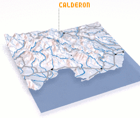 Places with similar names to Calderón, Dominican Republic ::
Disclaimer :: Information on this page comes without warranty of any kind |
||
|
Where is Calderón? Elevation and coordinates ::
Latitude (lat): 18°46'0"N Longitude (lon): 70°32'0"W
Elevation (approx.): 1120m (map arrows pan, magnifying glasses zoom) |
||
|
Visiting Calderón? Hotel/Accommodation ::
Book a hotel in Calderón Travel Guide ::
rental cars ::
car rental offers GPS waypoint ::
download a GPX waypoint (PoI) of Calderón for your GPS receiver
|
||