|
search place name
|
||
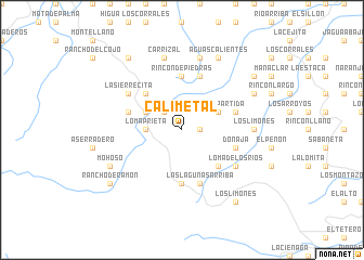
Calimetal (Santiago, Dominican Republic)Calimetal is a town in the Santiago region of Dominican Republic. An overview map of the region around Calimetal is displayed below.
regional and 3d topo map of Calimetal, Dominican Republic ::
Calimetal airports ::
The nearest airport is STI - Santiago Cibao Intl, located 43.9 km north east of Calimetal.
Other airports nearby include POP - Puerto Plata Gregorio Luperon Intl (75.1 km north east), BRX - Barahona Maria Montez Intl (104.7 km south), CAP - Cap Haitien Intl (144.2 km north west), PAP - Port-au-prince Toussaint Louverture Intl (156.4 km south west), Nearby towns ::
Jamamú Abajo (1.8km east) //
Cercadillo (1.8km east) //
Sabaneta (2.5km north west) //
Mata Grande (2.5km north west) //
Loma Prieta (3.5km west) //
Los Junquitos (4.0km north west) //
Piedra Partida (4.0km north east) //
Las Lagunas (5.1km south east) //
Arroyo Prieto (5.1km north west) //
Jamamú (5.6km north) //
Jamamucito (5.6km south) //
Rincón de Piedras (5.6km north) //
Donajá (5.6km east) //
Antonsape (5.6km west) //
Las Placetas Arriba (5.6km east) //
Las Lagunas Arriba (5.8km south) //
Corocitos (5.8km north) //
Loma de los Ríos (6.4km south east) //
La Sierrecita (6.4km north west) //
Los Limones (7.0km east) //
Carrizal (7.6km north) //
Guázuma (7.6km north) //
Tierra Colorada (7.6km north) //
Mohoso (7.9km south west) //
Aguas Calientes (8.2km north east) //
La Guázuma (8.2km north east) //
Las Placetas (7.9km north east) //
Los Limones (9.1km south east) //
El Dajao (9.1km north west) //
[all distances 'as the bird flies' and approximate] 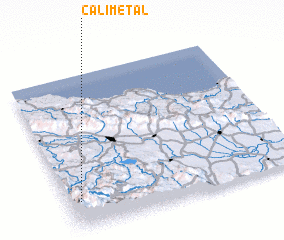 Places with similar names to Calimetal, Dominican Republic ::
// Kal Matalī (IR)
// Kūlām Talī (IR)
// Gal Madowle (SO)
// Galambdůlő (HU)
// Golemi Dol (CS)
// Kalimadola (MW)
Disclaimer :: Information on this page comes without warranty of any kind |
||
|
Where is Calimetal? Elevation and coordinates ::
Latitude (lat): 19°11'0"N Longitude (lon): 70°57'0"W
Elevation (approx.): 1111m (map arrows pan, magnifying glasses zoom) |
||
|
Visiting Calimetal? Hotel/Accommodation ::
Book a hotel in Calimetal Travel Guide ::
rental cars ::
car rental offers GPS waypoint ::
download a GPX waypoint (PoI) of Calimetal for your GPS receiver
|
||