|
search place name
|
||
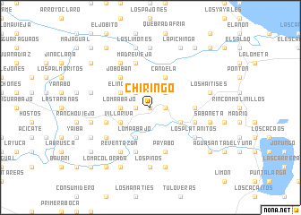
Chiringo (Duarte, Dominican Republic)Chiringo is a town in the Duarte region of Dominican Republic. An overview map of the region around Chiringo is displayed below.
regional and 3d topo map of Chiringo, Dominican Republic ::
Chiringo airports ::
The nearest airport is STI - Santiago Cibao Intl, located 79.2 km west of Chiringo.
Other airports nearby include SDQ - Santo Domingo Las Americas Intl (88.2 km south), POP - Puerto Plata Gregorio Luperon Intl (94.9 km north west), LRM - La Romana Casa De Campo Intl (131.8 km south east), BRX - Barahona Maria Montez Intl (167.5 km south west), Nearby towns ::
Zumba (NaNkm north) //
Loma Grande (1.8km east) //
Higüero (1.8km west) //
Loma El Firme (2.5km north east) //
Yabacoa (2.5km north east) //
Loma Arriba (2.5km north west) //
Loma Abajo (3.5km west) //
Candela (4.1km north east) //
Loma Abajo (4.1km south west) //
Junco Verde (4.1km south west) //
Arenoso (4.0km south east) //
Villa Riva (4.0km south west) //
El Manguito (4.0km south west) //
Azucey (4.0km south west) //
El Indio (4.0km north west) //
Jobobán (5.1km north west) //
El Aguacate (5.3km east) //
Payabo (5.8km south) //
Ciénaga Vieja (5.6km east) //
El Abanico (5.6km west) //
La Estrechura (5.8km south) //
Madre Vieja (5.8km north) //
El Junco (5.8km south) //
Los Platanitos (6.4km south east) //
La Sabana (6.4km south west) //
Ceiba de Los Pájaros (6.6km south west) //
Reventazón (6.6km south west) //
El Campamento (6.6km north west) //
El Pozo (7.4km north) //
[all distances 'as the bird flies' and approximate]  Places with similar names to Chiringo, Dominican Republic ::
Disclaimer :: Information on this page comes without warranty of any kind |
||
|
Where is Chiringo? Elevation and coordinates ::
Latitude (lat): 19°12'0"N Longitude (lon): 69°53'0"W
Elevation (approx.): 25m (map arrows pan, magnifying glasses zoom) |
||
|
Visiting Chiringo? Hotel/Accommodation ::
Book a hotel in Chiringo Travel Guide ::
rental cars ::
car rental offers GPS waypoint ::
download a GPX waypoint (PoI) of Chiringo for your GPS receiver
|
||