|
search place name
|
||
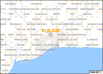
El Algibe (Distrito Nacional, Dominican Republic)El Algibe is a town in the Distrito Nacional region of Dominican Republic. An overview map of the region around El Algibe is displayed below.
regional and 3d topo map of El Algibe, Dominican Republic ::
El Algibe airports ::
The nearest airport is SDQ - Santo Domingo Las Americas Intl, located 25.6 km east of El Algibe.
Other airports nearby include LRM - La Romana Casa De Campo Intl (104.5 km east), STI - Santiago Cibao Intl (124.8 km north west), BRX - Barahona Maria Montez Intl (131.9 km west), POP - Puerto Plata Gregorio Luperon Intl (156.1 km north west), Nearby towns ::
Simón Bolivar (0.0km north) //
La Caridad (0.0km north) //
Capotillo (0.0km north) //
Ensanche Luperón (0.0km north) //
La Barquita de Santa Cruz (1.8km west) //
Villas Agrícolas Número Uno (1.8km west) //
Barrio Obrero (1.8km west) //
Villa Consuelo (1.9km south) //
Villa María (1.9km south) //
Barrio Mejoraminto Social (1.9km south) //
La Faría (1.9km south) //
El Ensanchito (1.9km south) //
San Carlos (1.9km south) //
San Martín de Porres (1.8km east) //
Ensanche Presidente Espaillat (1.8km east) //
Agua Dulce (1.8km east) //
Manganagua (1.8km east) //
Las Cañitas (1.8km east) //
Barrio María Auxiliadora (1.8km east) //
Santa Cruz (2.6km north west) //
Timbeque (2.6km south east) //
La Fuente (2.6km south east) //
Calero (2.6km south east) //
Los Tres Brazos (2.6km north east) //
Arroyo Salado (3.5km west) //
La Agustina (3.5km west) //
El Cachón (3.5km west) //
Colonia Agrícola (3.5km west) //
Cristo Rey (3.5km west) //
[all distances 'as the bird flies' and approximate]  Places with similar names to El Algibe, Dominican Republic ::
Disclaimer :: Information on this page comes without warranty of any kind |
||
|
Where is El Algibe? Elevation and coordinates ::
Latitude (lat): 18°30'0"N Longitude (lon): 69°54'0"W
Elevation (approx.): 44m (map arrows pan, magnifying glasses zoom) |
||
|
Visiting El Algibe? Hotel/Accommodation ::
Book a hotel in El Algibe Travel Guide ::
rental cars ::
car rental offers GPS waypoint ::
download a GPX waypoint (PoI) of El Algibe for your GPS receiver
|
||