|
search place name
|
||
El Cruce del Quince (Azua, Dominican Republic)El Cruce del Quince is a town in the Azua region of Dominican Republic. An overview map of the region around El Cruce del Quince is displayed below.
regional and 3d topo map of El Cruce del Quince, Dominican Republic ::

El Cruce del Quince airports ::
The nearest airport is BRX - Barahona Maria Montez Intl, located 35.9 km south west of El Cruce del Quince.
Other airports nearby include STI - Santiago Cibao Intl (107.6 km north), SDQ - Santo Domingo Las Americas Intl (126.6 km east), POP - Puerto Plata Gregorio Luperon Intl (146.3 km north), PAP - Port-au-prince Toussaint Louverture Intl (151.1 km west), Nearby towns ::
Tábara Abajo (3.5km west) //
Las Lajas (4.1km south west) //
Orégano Chiquito (5.8km north) //
Las Hormigas (6.6km north west) //
La Guanábana (7.4km north) //
Cuesta Blanca (7.4km north) //
Galindo Afuera (7.6km south) //
San Antonio (7.7km south west) //
La Vetania (7.9km north east) //
El Carrizal (9.1km north east) //
Las Barías (9.0km south east) //
La Victoria (10.2km south east) //
La Ciénaga (10.2km south east) //
[all distances 'as the bird flies' and approximate] 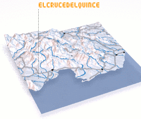 Places with similar names to El Cruce del Quince, Dominican Republic :: Disclaimer :: Information on this page comes without warranty of any kind |
||
|
Where is El Cruce del Quince? Elevation and coordinates ::
Latitude (lat): 18°28'0"N Longitude (lon): 70°52'0"W
Elevation (approx.): 140m (map arrows pan, magnifying glasses zoom) |
||
|
Visiting El Cruce del Quince? Hotel/Accommodation ::
Book a hotel in El Cruce del Quince Travel Guide ::
rental cars ::
car rental offers GPS waypoint ::
download a GPX waypoint (PoI) of El Cruce del Quince for your GPS receiver
|
||