|
search place name
|
||
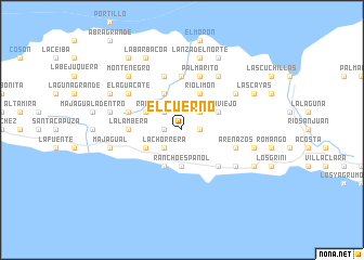
El Cuerno (Samaná, Dominican Republic)El Cuerno is a town in the Samaná region of Dominican Republic. An overview map of the region around El Cuerno is displayed below.
regional and 3d topo map of El Cuerno, Dominican Republic ::
El Cuerno airports ::
The nearest airport is SDQ - Santo Domingo Las Americas Intl, located 92.4 km south of El Cuerno.
Other airports nearby include LRM - La Romana Casa De Campo Intl (102.6 km south east), STI - Santiago Cibao Intl (124.6 km west), POP - Puerto Plata Gregorio Luperon Intl (132.7 km north west), PUJ - Punta Cana Intl (134.7 km south east), Nearby towns ::
Juana Vicenta (1.7km east) //
La Balsa (1.7km west) //
La Chorrera (2.5km south west) //
El Grigrí (2.5km south west) //
Bonilla (2.5km north east) //
Rancho Español (2.5km north west) //
Arroyo Chico Abajo (2.5km north west) //
Rancho Español (3.7km south) //
Hato Viejo (4.0km north east) //
Arroyo Barril (4.1km south west) //
Río Limón (4.1km north east) //
Los Róbalos (4.0km south west) //
Loma La Cruz (4.1km north west) //
La Guázara (4.0km north west) //
La Pascuala (5.1km south east) //
Los Corozos (5.1km south east) //
Arroyo Lucas (5.1km south east) //
La Lambera (5.2km west) //
El Limón (5.6km north) //
El Café (5.6km north) //
Otra Banda (5.6km north) //
Majagualito (5.6km east) //
Arenazos (5.6km east) //
Los Calabacitos (5.8km north) //
Palmarito (5.8km north) //
Arroyo Chico Arriba (5.6km west) //
Arroyo Surdió (5.8km north) //
Caña Félix (6.6km north east) //
Río Los Cocos (6.4km south east) //
[all distances 'as the bird flies' and approximate] 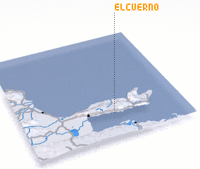 Places with similar names to El Cuerno, Dominican Republic ::
// El Caraño (PA)
// El Caraño (PA)
// El Carrión (PA)
// El Agraïne (TN)
// Elk Run (US)
// El Cariño (CO)
// El Guarne (CO)
// El Careño (MX)
// El Cariño (MX)
// El Cuerón (MX)
Disclaimer :: Information on this page comes without warranty of any kind |
||
|
Where is El Cuerno? Elevation and coordinates ::
Latitude (lat): 19°14'0"N Longitude (lon): 69°26'0"W
Elevation (approx.): 313m (map arrows pan, magnifying glasses zoom) |
||
|
Visiting El Cuerno? Hotel/Accommodation ::
Book a hotel in El Cuerno Travel Guide ::
rental cars ::
car rental offers GPS waypoint ::
download a GPX waypoint (PoI) of El Cuerno for your GPS receiver
|
||