|
search place name
|
||
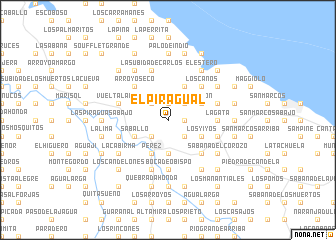
El Piragual (Puerto Plata, Dominican Republic)El Piragual is a town in the Puerto Plata region of Dominican Republic. An overview map of the region around El Piragual is displayed below.
regional and 3d topo map of El Piragual, Dominican Republic ::
El Piragual airports ::
The nearest airport is POP - Puerto Plata Gregorio Luperon Intl, located 26.0 km east of El Piragual.
Other airports nearby include STI - Santiago Cibao Intl (47.3 km south east), CAP - Cap Haitien Intl (144.5 km west), BRX - Barahona Maria Montez Intl (172.6 km south), SDQ - Santo Domingo Las Americas Intl (192.5 km south east), Nearby towns ::
Los Mates (1.7km east) //
Las Avispas (1.9km north) //
Los Cacaos (1.9km north) //
Los Campeches (2.5km south west) //
Los Silverio (2.5km south east) //
El Puerto (2.5km south east) //
Los Campeches (2.5km north west) //
La Colorada (2.5km north west) //
La Lomita del Guano (2.5km north east) //
Hojas Anchas (3.7km south) //
Saballo (3.9km south west) //
Imbert (4.1km south west) //
Pérez (4.1km south west) //
Los Yiyos (3.9km south east) //
El Rincón (4.1km north east) //
Maimón (3.9km north east) //
Arroyo Seco (5.1km north west) //
Barrabás (5.1km south east) //
Los Caños (5.1km north east) //
La Gata (5.2km east) //
Boca de Obispo (5.6km south) //
Las Piraguas Arriba (5.6km west) //
La Aguadita (5.6km east) //
Ingenio Amistad (5.8km south) //
Llanos de Pérez (5.8km south) //
La Subida de Carlos (5.8km north) //
Vuelta Larga (5.6km west) //
Loma de Las Bestias (5.6km east) //
Sabana del Corozo (6.4km south east) //
[all distances 'as the bird flies' and approximate] 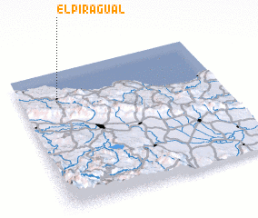 Places with similar names to El Piragual, Dominican Republic ::
Disclaimer :: Information on this page comes without warranty of any kind |
||
|
Where is El Piragual? Elevation and coordinates ::
Latitude (lat): 19°47'0"N Longitude (lon): 70°49'0"W
Elevation (approx.): 172m (map arrows pan, magnifying glasses zoom) |
||
|
Visiting El Piragual? Hotel/Accommodation ::
Book a hotel in El Piragual Travel Guide ::
rental cars ::
car rental offers GPS waypoint ::
download a GPX waypoint (PoI) of El Piragual for your GPS receiver
|
||