|
search place name
|
||
El Zanjón (Valverde, Dominican Republic)El Zanjón is a town in the Valverde region of Dominican Republic. An overview map of the region around El Zanjón is displayed below.
regional and 3d topo map of El Zanjón, Dominican Republic ::

El Zanjón airports ::
The nearest airport is STI - Santiago Cibao Intl, located 35.7 km south east of El Zanjón.
Other airports nearby include POP - Puerto Plata Gregorio Luperon Intl (44.0 km north east), CAP - Cap Haitien Intl (135.9 km west), BRX - Barahona Maria Montez Intl (143.5 km south), PAP - Port-au-prince Toussaint Louverture Intl (179.2 km south west), Nearby towns ::
El Remate (0.0km north) //
Jinamagao Arriba (0.0km north) //
Hundidera (1.9km south) //
Guatapanal (1.9km south) //
Fiñianca (1.9km south) //
Jinamagao (1.9km north) //
Las Cañas (4.0km south west) //
Jinamagao Abajo (4.0km south west) //
La Capilla (4.0km south east) //
El Túnel (4.0km south east) //
Mejía (4.0km north east) //
Pontoncito (4.1km north east) //
Pontón (4.1km north east) //
Piedra Gorda (5.1km south east) //
Peñuela (5.1km north west) //
Mejía de Navarrete (5.1km north east) //
Cruce de Barrero (5.6km north) //
La Sabana (5.6km west) //
Bejucal (5.8km north) //
Tierra Fría (5.6km west) //
Platanal (6.4km south east) //
Cibao (6.6km north west) //
Villa Bisonó (6.4km north east) //
Peñuela Abajo (6.4km north west) //
Batey Amina (7.0km west) //
Potrero (7.6km south) //
Jaiquí Picado (7.6km south) //
Barrancón (7.2km east) //
La Atravesada (7.6km north east) //
[all distances 'as the bird flies' and approximate] 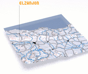 Places with similar names to El Zanjón, Dominican Republic ::
Disclaimer :: Information on this page comes without warranty of any kind |
||
|
Where is El Zanjón? Elevation and coordinates ::
Latitude (lat): 19°32'0"N Longitude (lon): 70°55'0"W
Elevation (approx.): 122m (map arrows pan, magnifying glasses zoom) |
||
|
Visiting El Zanjón? Hotel/Accommodation ::
Book a hotel in El Zanjón Travel Guide ::
rental cars ::
car rental offers GPS waypoint ::
download a GPX waypoint (PoI) of El Zanjón for your GPS receiver
|
||