|
search place name
|
||
La Cejita (La Altagracia, Dominican Republic)La Cejita is a town in the La Altagracia region of Dominican Republic. An overview map of the region around La Cejita is displayed below.
regional and 3d topo map of La Cejita, Dominican Republic ::

La Cejita airports ::
The nearest airport is LRM - La Romana Casa De Campo Intl, located 6.8 km west of La Cejita.
Other airports nearby include PUJ - Punta Cana Intl (52.6 km east), SDQ - Santo Domingo Las Americas Intl (86.6 km west), MAZ - Mayaguez Eugenio Maria De Hostos (181.3 km east), BQN - Aguadilla Rafael Hernandez (181.7 km east), Nearby towns ::
Cañada de la Jina (1.9km south) //
Las Cejas (2.6km north east) //
Benedicto (2.6km south east) //
Santa Cruz de Gato (2.6km south west) //
Batey Las Cejas (4.0km north east) //
El Ancón (4.0km north west) //
Batey Cinco (4.1km north east) //
Cuesta Caribe (4.0km south east) //
Ballestero (4.0km south west) //
El Infiernito (5.1km south west) //
Mirapato (5.6km north) //
El Pozo (5.3km east) //
Esperanza (5.3km west) //
Batey Caimito (5.3km west) //
Lithgó (5.3km west) //
Batey La Magdalena (5.6km east) //
Batey Santoni (5.6km west) //
Los Cinco Caminos (5.8km south) //
La Botijuela (5.8km south) //
Gran Calle (5.6km west) //
Pestaña (6.6km north east) //
El Coyá (6.6km north east) //
Córsica (6.6km north west) //
Ramón Gordo (7.0km east) //
Colón (7.6km north) //
Magdalena (7.3km east) //
El Junco (7.3km east) //
Culebra (7.7km north west) //
Boca de Chavón (8.2km south west) //
[all distances 'as the bird flies' and approximate] 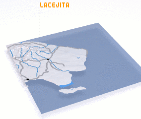 Places with similar names to La Cejita, Dominican Republic ::
Disclaimer :: Information on this page comes without warranty of any kind |
||
|
Where is La Cejita? Elevation and coordinates ::
Latitude (lat): 18°28'0"N Longitude (lon): 68°51'0"W
Elevation (approx.): 74m (map arrows pan, magnifying glasses zoom) |
||
|
Visiting La Cejita? Hotel/Accommodation ::
Book a hotel in La Cejita Travel Guide ::
rental cars ::
car rental offers GPS waypoint ::
download a GPX waypoint (PoI) of La Cejita for your GPS receiver
|
||