|
search place name
|
||
La Colesita (Sánchez Ramírez, Dominican Republic)La Colesita is a town in the Sánchez Ramírez region of Dominican Republic. An overview map of the region around La Colesita is displayed below.
regional and 3d topo map of La Colesita, Dominican Republic ::

La Colesita airports ::
The nearest airport is STI - Santiago Cibao Intl, located 74.3 km north west of La Colesita.
Other airports nearby include SDQ - Santo Domingo Las Americas Intl (76.2 km south east), POP - Puerto Plata Gregorio Luperon Intl (99.1 km north west), LRM - La Romana Casa De Campo Intl (133.2 km south east), BRX - Barahona Maria Montez Intl (145.1 km south west), Nearby towns ::
La Cueva (1.8km west) //
El Cruce de Segundo (1.8km west) //
El Blanco (1.9km north) //
Sabana Grande (1.9km north) //
La Mora (2.6km south west) //
La Colesita Arriba (2.6km north west) //
Los Peralejos (2.6km south east) //
El Caño (2.6km north east) //
Sabana Grande Arriba (3.5km west) //
Hoyo de Luis (3.5km west) //
El Pozo de la Ceiba (3.7km north) //
Primera Boca (3.7km north) //
Laguna Grande (3.5km east) //
La Zumbadora (4.0km north west) //
La Trocha (4.1km north west) //
El Pelú (4.1km north west) //
Sabana del Mariscao (4.0km south east) //
Sabana Chiquita (4.1km north east) //
Sabana Grande de Cevicos (4.0km north east) //
Taranal (4.0km north east) //
Sabana Abajo (4.0km north east) //
Monte Claro (5.1km north west) //
Sabana del Río (5.1km south east) //
Cevicos (5.1km south east) //
Los Cerros (5.3km west) //
El Cruce de Vásquez (5.3km west) //
Hoya Larga (5.6km north) //
Los Tamarindos (5.6km east) //
Las Guáyigas (5.6km east) //
[all distances 'as the bird flies' and approximate] 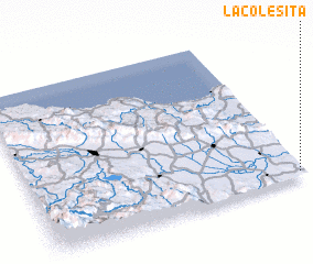 Places with similar names to La Colesita, Dominican Republic ::
// La Calzada (PA)
// La Calzada (CU)
// Leiculeşti (RO)
// Luculeşti (RO)
// La Calzada (ES)
// La Calzada (SV)
// La Calzada (MX)
// La Calzada (MX)
// La Calzada (MX)
// La Calzada (PE)
Disclaimer :: Information on this page comes without warranty of any kind |
||
|
Where is La Colesita? Elevation and coordinates ::
Latitude (lat): 19°2'0"N Longitude (lon): 70°1'0"W
Elevation (approx.): 88m (map arrows pan, magnifying glasses zoom) |
||
|
Visiting La Colesita? Hotel/Accommodation ::
Book a hotel in La Colesita Travel Guide ::
rental cars ::
car rental offers GPS waypoint ::
download a GPX waypoint (PoI) of La Colesita for your GPS receiver
|
||