|
search place name
|
||
La Ermita (Santiago, Dominican Republic)La Ermita is a town in the Santiago region of Dominican Republic. An overview map of the region around La Ermita is displayed below.
regional and 3d topo map of La Ermita, Dominican Republic ::

La Ermita airports ::
The nearest airport is STI - Santiago Cibao Intl, located 6.7 km south of La Ermita.
Other airports nearby include POP - Puerto Plata Gregorio Luperon Intl (32.4 km north), BRX - Barahona Maria Montez Intl (145.3 km south), SDQ - Santo Domingo Las Americas Intl (151.0 km south east), CAP - Cap Haitien Intl (169.9 km west), Nearby towns ::
Licey al Medio (0.0km north) //
Boca de Maizal (1.9km north) //
Tamboril (1.9km north) //
Canca Abajo (1.7km east) //
Licey Arriba (1.7km west) //
Monte Adentro (1.9km south) //
Don Pedro Arriba (1.7km west) //
Nigua (2.5km north east) //
Canca La Piedra (2.5km north east) //
Maizal (2.5km north east) //
Guazumal Abajo (2.5km north west) //
La Ceiba de Madera (3.5km east) //
Boca Maizal (3.7km north) //
Don Pedro Abajo (3.5km west) //
La Cruz de María Francisca (3.7km south) //
Licey al Medio (3.7km south) //
Los Amaceyes Abajo (4.0km north east) //
Canca Arriba (4.1km north east) //
Juan C. Estrella (4.0km south east) //
Onésimo Polanco (4.0km south east) //
Monte Adentro Arriba (4.0km south west) //
Licey (4.0km south west) //
Canca Reina (4.1km south east) //
Limonal Arriba (4.1km south west) //
Guazumal Arriba (5.1km north west) //
San Francisco Arriba (5.1km south east) //
Las Bocas del Licey (5.6km north) //
Licey Arriba (5.6km south) //
Pontezuela Arriba (5.2km west) //
[all distances 'as the bird flies' and approximate] 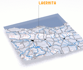 Places with similar names to La Ermita, Dominican Republic ::
Disclaimer :: Information on this page comes without warranty of any kind |
||
|
Where is La Ermita? Elevation and coordinates ::
Latitude (lat): 19°28'0"N Longitude (lon): 70°36'0"W
Elevation (approx.): 228m (map arrows pan, magnifying glasses zoom) |
||
|
Visiting La Ermita? Hotel/Accommodation ::
Book a hotel in La Ermita Travel Guide ::
rental cars ::
car rental offers GPS waypoint ::
download a GPX waypoint (PoI) of La Ermita for your GPS receiver
|
||