|
search place name
|
||
La Golondrina (Azua, Dominican Republic)La Golondrina is a town in the Azua region of Dominican Republic. An overview map of the region around La Golondrina is displayed below.
regional and 3d topo map of La Golondrina, Dominican Republic ::

La Golondrina airports ::
The nearest airport is BRX - Barahona Maria Montez Intl, located 47.3 km south west of La Golondrina.
Other airports nearby include STI - Santiago Cibao Intl (98.4 km north), SDQ - Santo Domingo Las Americas Intl (118.3 km east), POP - Puerto Plata Gregorio Luperon Intl (137.4 km north), PAP - Port-au-prince Toussaint Louverture Intl (159.4 km west), Nearby towns ::
Las Lomas (1.8km east) //
Las Cuarenta (1.8km east) //
Barro Arriba (1.9km south) //
La Clavellina (2.6km south east) //
El Caño (2.6km south east) //
El Pozo Colorado (2.6km north west) //
Majagual (2.6km north west) //
Barro al Medio (3.7km south) //
El Carrizal (3.5km west) //
Los Paniaguas (4.1km south east) //
Monte Grande (4.0km north east) //
La Vetania (4.1km south west) //
Puerta Vieja (4.1km north east) //
Los Candelones (5.1km south east) //
La Vereda (5.1km south east) //
El Pozo (5.6km south) //
Betania (5.6km south) //
La Altagracia (5.6km south) //
Sonador (5.6km north) //
Higüerito (5.8km south) //
La Mina (5.8km south) //
La Cruz de los Calabazos (5.8km south) //
Peralta (5.8km north) //
Titomina (5.6km east) //
Maleno (5.6km west) //
Palo Machete (5.6km west) //
Manaclar (6.4km north east) //
Palo de Chanche (6.4km north east) //
Mano Izquierda (6.4km north east) //
[all distances 'as the bird flies' and approximate] 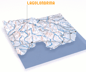 Places with similar names to La Golondrina, Dominican Republic ::
// La Golondrina (PA)
// La Golondrina (CO)
// La Golondrina (CO)
// La Golondrina (MX)
// La Golondrina (HN)
// La Golondrina (HN)
// La Golondrina (HN)
// La Golondrina (DO)
Disclaimer :: Information on this page comes without warranty of any kind |
||
|
Where is La Golondrina? Elevation and coordinates ::
Latitude (lat): 18°32'0"N Longitude (lon): 70°47'0"W
Elevation (approx.): 275m (map arrows pan, magnifying glasses zoom) |
||
|
Visiting La Golondrina? Hotel/Accommodation ::
Book a hotel in La Golondrina Travel Guide ::
rental cars ::
car rental offers GPS waypoint ::
download a GPX waypoint (PoI) of La Golondrina for your GPS receiver
|
||