|
search place name
|
||
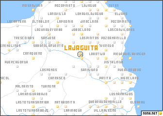
La Jagüita (María Trinidad Sánchez, Dominican Republic)La Jagüita is a town in the María Trinidad Sánchez region of Dominican Republic. An overview map of the region around La Jagüita is displayed below.
regional and 3d topo map of La Jagüita, Dominican Republic ::
La Jagüita airports ::
The nearest airport is POP - Puerto Plata Gregorio Luperon Intl, located 65.7 km west of La Jagüita.
Other airports nearby include STI - Santiago Cibao Intl (67.2 km west), SDQ - Santo Domingo Las Americas Intl (128.4 km south), LRM - La Romana Casa De Campo Intl (165.9 km south east), BRX - Barahona Maria Montez Intl (187.1 km south west), Nearby towns ::
Santa María (0.0km north) //
La Jagua (1.9km north) //
San Rafael (2.5km south east) //
Patrana (2.5km south west) //
El Pujador (3.5km east) //
El Brocal (3.5km east) //
La Botija (3.5km east) //
Los Pinitos (4.1km north east) //
Los Toritos (4.1km north east) //
San Isidro (4.1km south east) //
Palito Aletreado (4.0km south east) //
El Caimán (4.1km north west) //
Mella (4.0km north west) //
La Capilla (5.1km north east) //
Caño Claro (5.1km south east) //
Batey Laguneta (5.1km south west) //
Copeyito (5.1km south west) //
El Cruce (5.1km south west) //
Arroyo Azul (5.2km east) //
Jobo Claro (5.6km north) //
Caña Mala (5.6km north) //
El Picao (5.6km east) //
La Vereda (5.6km east) //
Caño Azul (5.6km east) //
Jobo Dulce (5.8km north) //
Caño Azul de los Cacaos (6.4km north west) //
Los Cacaos (6.6km north east) //
La Cabirma (7.4km north) //
Vista Linda (7.2km east) //
[all distances 'as the bird flies' and approximate] 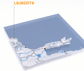 Places with similar names to La Jagüita, Dominican Republic ::
// La Jicotea (PA)
// La Jicotea (CU)
// La Jagüita (HN)
// La Jagüita (HN)
// La Jagüita (HN)
// La Jagüita (HN)
// La Jagüita (DO)
// La Jagüita (DO)
// La Jagüita (DO)
// La Jagüita (DO)
Disclaimer :: Information on this page comes without warranty of any kind |
||
|
Where is La Jagüita? Elevation and coordinates ::
Latitude (lat): 19°33'0"N Longitude (lon): 69°59'0"W
Elevation (approx.): 54m (map arrows pan, magnifying glasses zoom) |
||
|
Visiting La Jagüita? Hotel/Accommodation ::
Book a hotel in La Jagüita Travel Guide ::
rental cars ::
car rental offers GPS waypoint ::
download a GPX waypoint (PoI) of La Jagüita for your GPS receiver
|
||