|
search place name
|
||
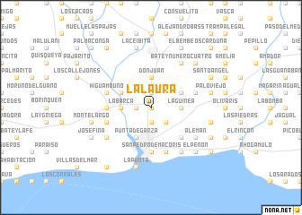
La Laura (San Pedro de Macorís, Dominican Republic)La Laura is a town in the San Pedro de Macorís region of Dominican Republic. An overview map of the region around La Laura is displayed below.
regional and 3d topo map of La Laura, Dominican Republic ::
La Laura airports ::
The nearest airport is SDQ - Santo Domingo Las Americas Intl, located 39.7 km west of La Laura.
Other airports nearby include LRM - La Romana Casa De Campo Intl (41.4 km east), PUJ - Punta Cana Intl (99.2 km east), STI - Santiago Cibao Intl (170.1 km north west), POP - Puerto Plata Gregorio Luperon Intl (193.0 km north west), Nearby towns ::
Batey Rancho la Altagracia (0.0km north) //
Ortiz (1.9km south) //
La Belleza (1.9km south) //
El Farito (1.9km north) //
Coloncito (1.8km west) //
La Inocencia (2.6km south east) //
Batey Los Conucos (3.5km east) //
La Guinea (3.5km east) //
Don Juan (3.7km north) //
La Barca (3.5km west) //
La Americana (4.0km north east) //
Batey San Juan Bautista (4.0km north east) //
Punta de Garza (4.1km south west) //
El Muelle (4.0km north west) //
La Fuente de Oro (4.0km north west) //
La Puerta de Santa Fe (5.1km south east) //
Cruce Quisqueya (5.3km west) //
San Pedro de Macorís (5.6km south) //
Batey Número Dos (5.6km west) //
Batey Monte Cristi (5.6km east) //
Higuamo Uno (5.6km west) //
Ingenio Porvenir (5.8km south) //
Esperanza (5.8km south) //
Alemán (6.4km south east) //
Hoyo del Toro (6.4km south west) //
Los Palitos (6.4km south east) //
Monte Adentro (6.6km south east) //
Batey Número Cuatro (6.6km north east) //
San Antón (6.6km south east) //
[all distances 'as the bird flies' and approximate] 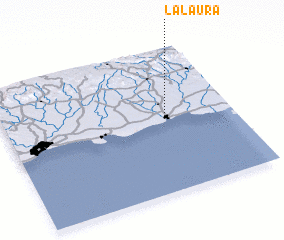 Places with similar names to La Laura, Dominican Republic ::
Disclaimer :: Information on this page comes without warranty of any kind |
||
|
Where is La Laura? Elevation and coordinates ::
Latitude (lat): 18°30'0"N Longitude (lon): 69°18'0"W
Elevation (approx.): 23m (map arrows pan, magnifying glasses zoom) |
||
|
Visiting La Laura? Hotel/Accommodation ::
Book a hotel in La Laura Travel Guide ::
rental cars ::
car rental offers GPS waypoint ::
download a GPX waypoint (PoI) of La Laura for your GPS receiver
|
||