|
search place name
|
||
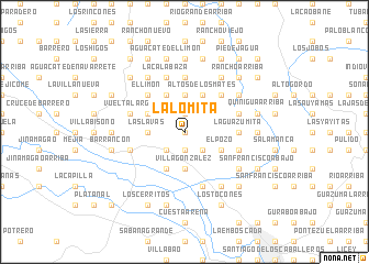
La Lomita (Santiago, Dominican Republic)La Lomita is a town in the Santiago region of Dominican Republic. An overview map of the region around La Lomita is displayed below.
regional and 3d topo map of La Lomita, Dominican Republic ::
La Lomita airports ::
The nearest airport is STI - Santiago Cibao Intl, located 25.8 km south east of La Lomita.
Other airports nearby include POP - Puerto Plata Gregorio Luperon Intl (30.8 km north east), CAP - Cap Haitien Intl (149.2 km west), BRX - Barahona Maria Montez Intl (149.8 km south), SDQ - Santo Domingo Las Americas Intl (172.1 km south east), Nearby towns ::
El Castillo (0.0km north) //
Mata Puerco (1.9km north) //
Pérez (1.9km north) //
Los Mates del Palmar (1.9km north) //
La Lomita de Palmar Abajo (1.9km south) //
Palmar Abajo (2.5km south east) //
El Rincón (2.5km south east) //
Palmarejo (2.5km south west) //
El Martillo (2.5km south west) //
Llano Grande (3.7km north) //
Higo de Agua (3.7km north) //
Villa González (3.7km south) //
Las Lagunas (3.7km south) //
Las Lavas (3.5km west) //
Altos de los Mates (4.1km north east) //
Los Chicharrones (4.1km north east) //
El Pozo (4.0km south east) //
Arroyo El Agua (4.0km south east) //
Macorís del Limón (4.1km north west) //
La Sabana (4.1km north west) //
La Pocilguita del Limón (4.0km north west) //
Los Uveros (4.0km north west) //
Banegas (4.1km south west) //
Manaclas (5.1km north east) //
El Limón (5.1km north west) //
La Guazumita (5.2km east) //
Escalera Arriba (5.6km north) //
Piche (5.6km east) //
Cruce de Quinigua (5.8km south) //
[all distances 'as the bird flies' and approximate] 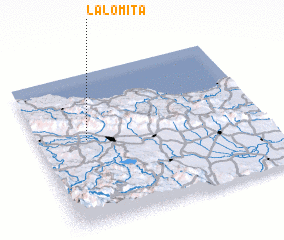 Places with similar names to La Lomita, Dominican Republic ::
// La Lomita (PA)
// La Alameda (ES)
// La Alameda (ES)
// La Alameda (ES)
// La Alameda (ES)
// La Alameda (ES)
// La Olmeda (ES)
// La Olmeda (ES)
// La Alameda (CO)
// La Lomita (CO)
Disclaimer :: Information on this page comes without warranty of any kind |
||
|
Where is La Lomita? Elevation and coordinates ::
Latitude (lat): 19°34'0"N Longitude (lon): 70°47'0"W
Elevation (approx.): 346m (map arrows pan, magnifying glasses zoom) |
||
|
Visiting La Lomita? Hotel/Accommodation ::
Book a hotel in La Lomita Travel Guide ::
rental cars ::
car rental offers GPS waypoint ::
download a GPX waypoint (PoI) of La Lomita for your GPS receiver
|
||