|
search place name
|
||
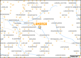
La Manga (San Juan, Dominican Republic)La Manga is a town in the San Juan region of Dominican Republic. An overview map of the region around La Manga is displayed below.
regional and 3d topo map of La Manga, Dominican Republic ::
La Manga airports ::
The nearest airport is BRX - Barahona Maria Montez Intl, located 77.3 km south east of La Manga.
Other airports nearby include PAP - Port-au-prince Toussaint Louverture Intl (96.6 km west), STI - Santiago Cibao Intl (104.6 km north east), CAP - Cap Haitien Intl (123.5 km north west), POP - Puerto Plata Gregorio Luperon Intl (132.7 km north east), Nearby towns ::
Pedro Corto (4.1km south east) //
La Ceiba (4.1km south east) //
Tres Mangas (4.1km north west) //
Los Amargos (4.0km north west) //
Los Barreros (5.1km north east) //
Los Derramaderos (5.3km west) //
El Pajonal (5.3km west) //
La China (5.6km north) //
Carrera de Burro (5.6km west) //
Comedero Vallo (5.6km west) //
Corral Falso (5.6km west) //
El Calabozo (5.6km west) //
Sabana Tuna (5.6km west) //
Pascal (5.6km west) //
Sabana de Sierra (6.4km south west) //
Media Cara (6.6km south east) //
El Pando (6.4km north west) //
San José (6.6km south west) //
Las Mulas (6.6km south west) //
Peso Fuerte (6.6km north west) //
Cañada Cadena (7.0km west) //
Cañada Honda (7.4km north) //
Babor (7.6km south) //
Pedro Sánchez (7.3km east) //
La Sierra (7.6km south) //
Los Zanjones (7.3km east) //
Yabonico (7.6km north) //
Guayacán (7.7km north west) //
Los Campeches (7.7km south west) //
[all distances 'as the bird flies' and approximate] 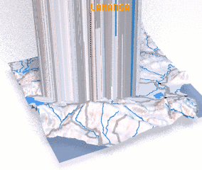 Places with similar names to La Manga, Dominican Republic ::
Disclaimer :: Information on this page comes without warranty of any kind |
||
|
Where is La Manga? Elevation and coordinates ::
Latitude (lat): 18°53'0"N Longitude (lon): 71°26'0"W
Elevation (approx.): 447m (map arrows pan, magnifying glasses zoom) |
||
|
Visiting La Manga? Hotel/Accommodation ::
Book a hotel in La Manga Travel Guide ::
rental cars ::
car rental offers GPS waypoint ::
download a GPX waypoint (PoI) of La Manga for your GPS receiver
|
||