|
search place name
|
||
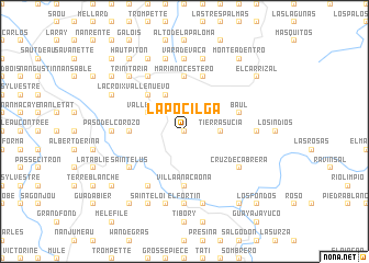
La Pocilga (Dajabón, Dominican Republic)La Pocilga is a town in the Dajabón region of Dominican Republic. An overview map of the region around La Pocilga is displayed below.
regional and 3d topo map of La Pocilga, Dominican Republic ::
La Pocilga airports ::
The nearest airport is CAP - Cap Haitien Intl, located 72.0 km north west of La Pocilga.
Other airports nearby include PAP - Port-au-prince Toussaint Louverture Intl (102.3 km south west), STI - Santiago Cibao Intl (113.9 km east), POP - Puerto Plata Gregorio Luperon Intl (127.4 km north east), BRX - Barahona Maria Montez Intl (130.4 km south east), Nearby towns ::
Neita Abajo (0.0km north) //
Restauración (1.9km north) //
Jiménez (1.9km north) //
Tierra Sucia (3.5km east) //
Tierra Sucia (4.1km north west) //
Valle Simón (4.0km north west) //
Valle Nuevo (5.1km north west) //
Corral de los Mangos (5.2km west) //
Mariano Cestero (5.6km north) //
Villa Anacaona (5.6km south) //
Cruce de Mariano Cestero (5.8km north) //
Baúl (5.6km east) //
Saintelus (6.4km south west) //
Cruz de Cabrera (6.4km south east) //
Guacacuba (6.6km north west) //
Maguana (6.6km south west) //
Los Cerezos (7.0km east) //
Paso del Corozo (7.0km west) //
Ti Lauri (7.4km south) //
Vara de Vaca (7.4km north) //
El Fortín (7.4km south) //
Fondo Grande (7.6km north) //
Pingouin (7.6km south) //
Tilory (7.6km south) //
Mérande (7.6km north) //
Terre Canne (7.6km south) //
Duval (7.6km north) //
Trinitaria (7.6km north west) //
La Croix (7.9km north west) //
[all distances 'as the bird flies' and approximate]  Places with similar names to La Pocilga, Dominican Republic ::
// La Pocilga (DO)
// La Pocilga (DO)
// La Pocilga (DO)
// La Pocilga (DO)
// La Pocilga (DO)
// La Pocilga (DO)
// Leppäselkä (FI)
Disclaimer :: Information on this page comes without warranty of any kind |
||
|
Where is La Pocilga? Elevation and coordinates ::
Latitude (lat): 19°18'0"N Longitude (lon): 71°41'0"W
Elevation (approx.): 531m (map arrows pan, magnifying glasses zoom) |
||
|
Visiting La Pocilga? Hotel/Accommodation ::
Book a hotel in La Pocilga Travel Guide ::
rental cars ::
car rental offers GPS waypoint ::
download a GPX waypoint (PoI) of La Pocilga for your GPS receiver
|
||