|
search place name
|
||
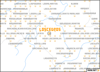
Los Cedros (Santiago, Dominican Republic)Los Cedros is a town in the Santiago region of Dominican Republic. An overview map of the region around Los Cedros is displayed below.
regional and 3d topo map of Los Cedros, Dominican Republic ::
Los Cedros airports ::
The nearest airport is STI - Santiago Cibao Intl, located 43.2 km east of Los Cedros.
Other airports nearby include POP - Puerto Plata Gregorio Luperon Intl (67.9 km north east), BRX - Barahona Maria Montez Intl (116.8 km south), CAP - Cap Haitien Intl (134.3 km west), PAP - Port-au-prince Toussaint Louverture Intl (157.8 km south west), Nearby towns ::
Quebrada Llana (0.0km north) //
La Cabirma (1.7km west) //
Llano del Jobo (1.7km east) //
El Limpio (1.9km south) //
Yerba Buena (2.5km north east) //
El Copey (2.5km north east) //
Los Naranjos (2.5km north west) //
Los Llanos (2.5km north east) //
Los Corrales (2.5km south east) //
Higua (2.5km south west) //
La Peña (3.5km east) //
Los Arroyos (3.5km west) //
La Yaya (3.5km west) //
Los Caimiticos (3.5km west) //
Los Burros (4.0km north west) //
La Patilla (4.1km north west) //
La Ceja de Higüero (5.1km north west) //
Monte Llano (5.1km south west) //
Cerro Negro (5.1km south west) //
El Dajao (5.6km south) //
El Mamey (5.6km east) //
El Llano de La Piedra (5.6km east) //
Vera de Amina (5.8km north) //
Inoa (5.8km north) //
Bernabé (5.8km north) //
El Bambú (6.4km north west) //
Los Higos Gordos (6.4km north west) //
La Guarana (6.4km north west) //
Arroyo Hondo (6.4km north east) //
[all distances 'as the bird flies' and approximate] 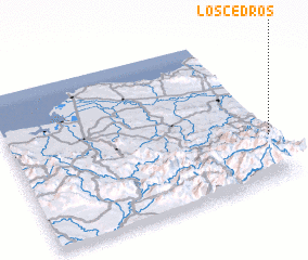 Places with similar names to Los Cedros, Dominican Republic ::
// Los Cedros (PA)
// Los Cedros (PA)
// Los Cedros (PA)
// Los Cedros (PA)
// Los Torres (PA)
// Los Cedros (CU)
// Los Cedros (CU)
// Los Cedros (CU)
// Luis Torres (CU)
// Las Torres (ES)
Disclaimer :: Information on this page comes without warranty of any kind |
||
|
Where is Los Cedros? Elevation and coordinates ::
Latitude (lat): 19°18'0"N Longitude (lon): 71°0'0"W
Elevation (approx.): 700m (map arrows pan, magnifying glasses zoom) |
||
|
Visiting Los Cedros? Hotel/Accommodation ::
Book a hotel in Los Cedros Travel Guide ::
rental cars ::
car rental offers GPS waypoint ::
download a GPX waypoint (PoI) of Los Cedros for your GPS receiver
|
||