|
search place name
|
||
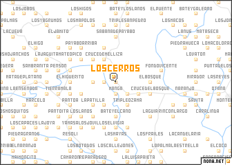
Los Cerros (Monte Plata, Dominican Republic)Los Cerros is a town in the Monte Plata region of Dominican Republic. An overview map of the region around Los Cerros is displayed below.
regional and 3d topo map of Los Cerros, Dominican Republic ::
Los Cerros airports ::
The nearest airport is SDQ - Santo Domingo Las Americas Intl, located 53.6 km south east of Los Cerros.
Other airports nearby include STI - Santiago Cibao Intl (93.6 km north west), LRM - La Romana Casa De Campo Intl (117.4 km east), POP - Puerto Plata Gregorio Luperon Intl (121.3 km north west), BRX - Barahona Maria Montez Intl (139.3 km south west), Nearby towns ::
Bermejo (0.0km north) //
Don Juan (0.0km north) //
Guazumita (1.9km south) //
Manga (1.9km south) //
Los Galanes (1.8km west) //
La Jagua (2.6km south east) //
Cruce de la Jagua (2.6km south east) //
Frías (2.6km north west) //
El Calvario (3.5km west) //
Cruce de la Avioneta (4.0km south east) //
Jagua Abajo (4.1km south east) //
Batey Nuevo (4.1km south west) //
Triple Ozama (4.1km south east) //
Antoncí (4.1km south west) //
El Bosque Arriba (4.0km north east) //
Cruce de Melliza (4.1km north west) //
La Patilla (5.1km south west) //
Batey Frías (5.1km north west) //
El Bosque (5.3km east) //
Batey El Caño (5.6km south) //
Cruce del Bosque (5.6km east) //
La Blanca (5.6km west) //
Hoyo de Pum (5.8km north) //
La Mina (6.6km south west) //
El Carmen (6.4km north west) //
Batey La Guázuma (6.4km north west) //
El Vigía (7.4km south) //
La Lisa (7.4km north) //
El Higüerito (7.0km west) //
[all distances 'as the bird flies' and approximate] 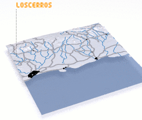 Places with similar names to Los Cerros, Dominican Republic ::
// Lausers (DE)
// Los Cerros (PA)
// Los Cerros (PA)
// Los Cerros (PA)
// Los Ríos (PA)
// Los Ríos (PA)
// Los Ríos (PA)
// Laceiras (PT)
// Laceiras (PT)
// Laceiras (PT)
Disclaimer :: Information on this page comes without warranty of any kind |
||
|
Where is Los Cerros? Elevation and coordinates ::
Latitude (lat): 18°50'0"N Longitude (lon): 69°57'0"W
Elevation (approx.): 58m (map arrows pan, magnifying glasses zoom) |
||
|
Visiting Los Cerros? Hotel/Accommodation ::
Book a hotel in Los Cerros Travel Guide ::
rental cars ::
car rental offers GPS waypoint ::
download a GPX waypoint (PoI) of Los Cerros for your GPS receiver
|
||