|
search place name
|
||
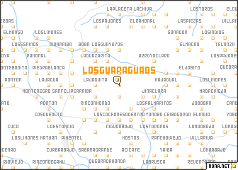
Los Guaraguaos (Duarte, Dominican Republic)Los Guaraguaos is a town in the Duarte region of Dominican Republic. An overview map of the region around Los Guaraguaos is displayed below.
regional and 3d topo map of Los Guaraguaos, Dominican Republic ::
Los Guaraguaos airports ::
The nearest airport is STI - Santiago Cibao Intl, located 62.0 km west of Los Guaraguaos.
Other airports nearby include POP - Puerto Plata Gregorio Luperon Intl (78.3 km north west), SDQ - Santo Domingo Las Americas Intl (100.3 km south), LRM - La Romana Casa De Campo Intl (148.7 km south east), BRX - Barahona Maria Montez Intl (160.5 km south west), Nearby towns ::
El Rucio (0.0km north) //
Loma Vieja (1.9km north) //
Juana Díaz (1.9km south) //
Las Berenjenas (2.5km north west) //
La Jagüita (3.5km west) //
La Jagua (3.5km west) //
Cuesta Blanca (4.0km south east) //
El Firme (4.1km north west) //
Los Cafeces (4.1km south east) //
Laguna de Coto (4.0km north west) //
Los Callejones (4.1km south west) //
Los Naranjos (4.0km south west) //
La Garata (5.1km south east) //
La Guazarita (5.1km north west) //
Maguá (5.1km south west) //
Rincón Hondo (5.1km south west) //
Los Lanos (5.1km south west) //
La Ceibita (5.1km south west) //
El Alto (5.1km south west) //
Castillo (5.6km south) //
Los Cachones Adentro (5.6km south) //
Firme del Calvario (5.6km north) //
El Pomo (5.6km north) //
Las Piedras (5.8km south) //
La Laguna (5.6km west) //
Coto (5.6km west) //
Jina Clara (5.6km east) //
Los Cachones (5.8km south) //
Los Guayuyos (5.8km north) //
[all distances 'as the bird flies' and approximate] 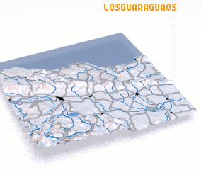 Places with similar names to Los Guaraguaos, Dominican Republic ::
// Las Charcas (CU)
// Las Charcas (CU)
// Las Charcas (CU)
// Las Charcas (CU)
// Lūšakrogs (LV)
// Los Charcos (ES)
// Los Charcos (ES)
// Los Charcos (ES)
// Los Griegos (US)
// Las Chiriguas (CL)
Disclaimer :: Information on this page comes without warranty of any kind |
||
|
Where is Los Guaraguaos? Elevation and coordinates ::
Latitude (lat): 19°16'0"N Longitude (lon): 70°2'0"W
Elevation (approx.): 320m (map arrows pan, magnifying glasses zoom) |
||
|
Visiting Los Guaraguaos? Hotel/Accommodation ::
Book a hotel in Los Guaraguaos Travel Guide ::
rental cars ::
car rental offers GPS waypoint ::
download a GPX waypoint (PoI) of Los Guaraguaos for your GPS receiver
|
||