|
search place name
|
||
Los Higüeros (San Pedro de Macorís, Dominican Republic)Los Higüeros is a town in the San Pedro de Macorís region of Dominican Republic. An overview map of the region around Los Higüeros is displayed below.
regional and 3d topo map of Los Higüeros, Dominican Republic ::

Los Higüeros airports ::
The nearest airport is SDQ - Santo Domingo Las Americas Intl, located 21.5 km west of Los Higüeros.
Other airports nearby include LRM - La Romana Casa De Campo Intl (58.6 km east), PUJ - Punta Cana Intl (117.2 km east), STI - Santiago Cibao Intl (159.9 km north west), BRX - Barahona Maria Montez Intl (176.2 km west), Nearby towns ::
El Rubio (1.8km west) //
El Caimito (2.6km south west) //
La Habitación (2.6km south east) //
Batey La Fe (2.6km north east) //
La Cañita (3.7km south) //
La Pava (3.7km south) //
Infiernito (3.7km south) //
Cruce de Salomones (3.7km north) //
La Salvadora (3.7km north) //
El Bronce (3.7km north) //
Cruce de los Guayacanes (3.7km north) //
Los Conucos (3.5km east) //
Sabaneta (4.1km south west) //
Cruce Cayacoa (4.1km north west) //
La Bordita (4.0km north west) //
Barco Viejo (4.1km south east) //
Guayacanes (4.1km south east) //
Agua Hedionda (5.1km south west) //
El Tintero (5.1km north west) //
La Puntica de Juan Dolio (5.1km south east) //
Las Mercedes (5.6km north) //
Paraíso (5.3km east) //
Cayacoa del Guano (5.8km north) //
Cruce El Ciego (5.6km west) //
Ciudad del Caribe (6.6km south west) //
Dos Hermanos (6.6km north west) //
Los Bancos de Arena (6.6km south west) //
Cayacoa de Boca Chica (6.4km north west) //
Juan Dolio (6.4km south east) //
[all distances 'as the bird flies' and approximate] 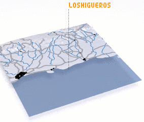 Places with similar names to Los Higüeros, Dominican Republic ::
// Las Higueras (ES)
// Las Higueras (ES)
// Las Higueras (CL)
// Las Higueras (SV)
// Las Higueras (SV)
// Las Higueras (MX)
// Las Higueras (MX)
// Las Higueras (MX)
// Las Higueras (MX)
// Las Higueras (MX)
Disclaimer :: Information on this page comes without warranty of any kind |
||
|
Where is Los Higüeros? Elevation and coordinates ::
Latitude (lat): 18°27'0"N Longitude (lon): 69°28'0"W
Elevation (approx.): 27m (map arrows pan, magnifying glasses zoom) |
||
|
Visiting Los Higüeros? Hotel/Accommodation ::
Book a hotel in Los Higüeros Travel Guide ::
rental cars ::
car rental offers GPS waypoint ::
download a GPX waypoint (PoI) of Los Higüeros for your GPS receiver
|
||