|
search place name
|
||
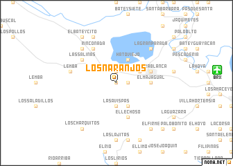
Los Naranjos (Barahona, Dominican Republic)Los Naranjos is a town in the Barahona region of Dominican Republic. An overview map of the region around Los Naranjos is displayed below.
regional and 3d topo map of Los Naranjos, Dominican Republic ::
Los Naranjos airports ::
The nearest airport is BRX - Barahona Maria Montez Intl, located 15.6 km east of Los Naranjos.
Other airports nearby include PAP - Port-au-prince Toussaint Louverture Intl (115.0 km west), STI - Santiago Cibao Intl (147.4 km north east), SDQ - Santo Domingo Las Americas Intl (170.3 km east), POP - Puerto Plata Gregorio Luperon Intl (184.0 km north east), Nearby towns ::
El Naranjo (0.0km north) //
El Fundo (0.0km north) //
La Lista (1.9km north) //
Juan Santiago (1.8km east) //
Las Avispas (3.7km south) //
Boca El Naranjo (4.1km south east) //
Hato Viejo (4.1km north east) //
Las Barías (4.0km north east) //
El Majagual (5.3km east) //
Tierra Blanca (5.6km east) //
Cabral (5.6km east) //
La Peñuela (5.6km east) //
El Lechoso (5.8km south) //
Rinconada (6.6km north west) //
Las Salinas (6.5km north west) //
Lemba (7.3km west) //
La Gran Parada (7.7km north east) //
Hato Nuevo (7.7km north west) //
Cristóbal (8.2km north west) //
Los Charquitos (9.1km south west) //
El Firme (9.1km south east) //
El Higüero (9.1km south west) //
El Bateycito (9.1km north west) //
Los Hierros (10.2km south east) //
Bernardino (10.2km south east) //
[all distances 'as the bird flies' and approximate] 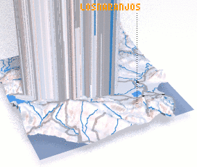 Places with similar names to Los Naranjos, Dominican Republic ::
// Los Naranjos (PA)
// Los Naranjos (PA)
// Los Naranjos (PA)
// Los Naranjos (PA)
// Los Naranjos (PA)
// Los Naranjos (PA)
// Los Naranjos (CU)
// Los Naranjos (CO)
// Los Naranjos (CO)
// Los Naranjos (CO)
Disclaimer :: Information on this page comes without warranty of any kind |
||
|
Where is Los Naranjos? Elevation and coordinates ::
Latitude (lat): 18°14'0"N Longitude (lon): 71°16'0"W
Elevation (approx.): 103m (map arrows pan, magnifying glasses zoom) |
||
|
Visiting Los Naranjos? Hotel/Accommodation ::
Book a hotel in Los Naranjos Travel Guide ::
rental cars ::
car rental offers GPS waypoint ::
download a GPX waypoint (PoI) of Los Naranjos for your GPS receiver
|
||