|
search place name
|
||
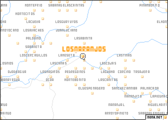
Los Naranjos (Azua, Dominican Republic)Los Naranjos is a town in the Azua region of Dominican Republic. An overview map of the region around Los Naranjos is displayed below.
regional and 3d topo map of Los Naranjos, Dominican Republic ::
Los Naranjos airports ::
The nearest airport is BRX - Barahona Maria Montez Intl, located 63.0 km south west of Los Naranjos.
Other airports nearby include STI - Santiago Cibao Intl (76.0 km north), POP - Puerto Plata Gregorio Luperon Intl (114.1 km north), SDQ - Santo Domingo Las Americas Intl (131.8 km east), PAP - Port-au-prince Toussaint Louverture Intl (151.8 km west), Nearby towns ::
La Siembra (0.0km north) //
El Desecho (0.0km north) //
Los Cambrones Derrumbado (0.0km north) //
La Cumbre (0.0km north) //
Los Negros (1.9km south) //
Las Lagunas (2.6km north west) //
Los Higos (2.6km south west) //
Periquito (2.6km south east) //
Los Corcinos (2.6km south east) //
La Sabinita (3.7km north) //
La Meseta (3.5km west) //
Cañada Difunta (4.1km south west) //
Pedregones (4.1km south west) //
Los Paticos (4.1km south west) //
El Guayabal (4.0km south east) //
La Coja (4.0km south east) //
Los Pomos (5.1km south west) //
Paleros (5.1km south west) //
La Trepada (5.1km south west) //
El Nuez (5.6km south) //
Monte Bonito (5.8km south) //
Las Cojas (5.6km east) //
Arroyo Yayas (5.6km west) //
Las Canas (5.6km west) //
Juan Luciano (6.6km north west) //
Arroyo Corozo (6.4km south east) //
La Guama (6.4km south east) //
El Despeñadero (7.6km south) //
Las Cañitas (7.7km south east) //
[all distances 'as the bird flies' and approximate]  Places with similar names to Los Naranjos, Dominican Republic ::
// Los Naranjos (PA)
// Los Naranjos (PA)
// Los Naranjos (PA)
// Los Naranjos (PA)
// Los Naranjos (PA)
// Los Naranjos (PA)
// Los Naranjos (CU)
// Los Naranjos (CO)
// Los Naranjos (CO)
// Los Naranjos (CO)
Disclaimer :: Information on this page comes without warranty of any kind |
||
|
Where is Los Naranjos? Elevation and coordinates ::
Latitude (lat): 18°46'0"N Longitude (lon): 70°52'0"W
Elevation (approx.): 652m (map arrows pan, magnifying glasses zoom) |
||
|
Visiting Los Naranjos? Hotel/Accommodation ::
Book a hotel in Los Naranjos Travel Guide ::
rental cars ::
car rental offers GPS waypoint ::
download a GPX waypoint (PoI) of Los Naranjos for your GPS receiver
|
||