|
search place name
|
||
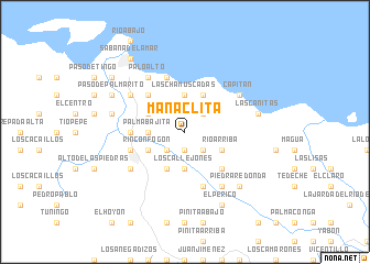
Manaclita (Hato Mayor, Dominican Republic)Manaclita is a town in the Hato Mayor region of Dominican Republic. An overview map of the region around Manaclita is displayed below.
regional and 3d topo map of Manaclita, Dominican Republic ::
Manaclita airports ::
The nearest airport is SDQ - Santo Domingo Las Americas Intl, located 72.4 km south west of Manaclita.
Other airports nearby include LRM - La Romana Casa De Campo Intl (75.3 km south east), PUJ - Punta Cana Intl (112.9 km south east), STI - Santiago Cibao Intl (141.1 km west), POP - Puerto Plata Gregorio Luperon Intl (154.7 km north west), Nearby towns ::
La Dominica (1.9km south) //
Río Arriba (2.6km north east) //
Los Plátanos (2.6km south east) //
La Jagüita (2.6km south west) //
Liar Grande (2.6km south west) //
El Zanjón (2.6km south west) //
Los Callejones (3.7km south) //
Las Chamuscadas (3.7km north) //
Palma Bajita (3.5km west) //
El Caño (4.1km north east) //
Guarúa (4.1km south west) //
La Vecina (4.0km south east) //
Río Arriba (4.0km south east) //
Escobar (4.0km north west) //
Rincón Fogón (4.0km south west) //
La Loma (5.1km south east) //
Arenitas (5.1km south east) //
Las Guázaras (5.1km north west) //
La Cruz (5.3km west) //
Los Barros (5.3km west) //
El Toro (5.8km south) //
Filipinas (5.8km south) //
Los Añiles (5.6km west) //
Las Chamuscadas (5.8km north) //
El Cerrito (6.4km north west) //
El Valle (6.4km south west) //
El Zumbador (6.6km south east) //
Capitán (6.4km north east) //
Palo Alto (6.6km north west) //
[all distances 'as the bird flies' and approximate]  Places with similar names to Manaclita, Dominican Republic ::
// Mangaladaw (MM)
// Manacolod (PH)
// Mañgalit (PH)
// Manglad (PH)
// Manglit (PH)
// Mangualde (PT)
// Mangualde (PT)
// Manguelito (CO)
// Manguelito (CO)
// Mangaldai (IN)
Disclaimer :: Information on this page comes without warranty of any kind |
||
|
Where is Manaclita? Elevation and coordinates ::
Latitude (lat): 19°0'0"N Longitude (lon): 69°20'0"W
Elevation (approx.): 243m (map arrows pan, magnifying glasses zoom) |
||
|
Visiting Manaclita? Hotel/Accommodation ::
Book a hotel in Manaclita Travel Guide ::
rental cars ::
car rental offers GPS waypoint ::
download a GPX waypoint (PoI) of Manaclita for your GPS receiver
|
||