|
search place name
|
||
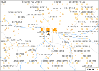
Naranjo (San Juan, Dominican Republic)Naranjo is a town in the San Juan region of Dominican Republic. An overview map of the region around Naranjo is displayed below.
regional and 3d topo map of Naranjo, Dominican Republic ::
Naranjo airports ::
The nearest airport is PAP - Port-au-prince Toussaint Louverture Intl, located 82.2 km south west of Naranjo.
Other airports nearby include BRX - Barahona Maria Montez Intl (88.5 km south east), CAP - Cap Haitien Intl (110.7 km north west), STI - Santiago Cibao Intl (117.7 km north east), POP - Puerto Plata Gregorio Luperon Intl (142.8 km north east), Nearby towns ::
Cercadillo (1.4km south west) //
Cara Linda (1.8km west) //
Rancho Juan (1.9km north east) //
Matayaya (2.4km south) //
La Estrelleta (2.6km south west) //
Olivero (2.6km south west) //
Miguel Martín (2.7km north east) //
Los Jobos Arriba (2.7km north east) //
Los Alejos (2.8km south west) //
El Barrero (2.7km west) //
Las Carreras (2.9km north) //
Buena Vista (3.5km south) //
Potro Blanco (3.6km north west) //
Los Molinos (3.9km south west) //
El Almácigo (5.0km south) //
Arroyo Saya (5.1km south) //
Cocinero (4.9km east) //
La Jagüita (5.4km north) //
Sabana Abajo (5.3km east) //
El Manjil (5.6km north east) //
El Charco del Mulo (5.7km north west) //
Los Barreros (5.8km south east) //
La Palma (6.3km north) //
El Papayo (6.2km north west) //
La Pocilga de Luciano (6.4km north) //
Sabana Larga (6.3km north west) //
Los Candelones (6.7km north east) //
El Corte (6.9km south) //
Los Jobos (6.6km east) //
[all distances 'as the bird flies' and approximate]  Places with similar names to Naranjo, Dominican Republic ::
Disclaimer :: Information on this page comes without warranty of any kind |
||
|
Where is Naranjo? Elevation and coordinates ::
Latitude (lat): 18°54'40"N Longitude (lon): 71°35'41"W
Elevation (approx.): 402m (map arrows pan, magnifying glasses zoom) |
||
|
Visiting Naranjo? Hotel/Accommodation ::
Book a hotel in Naranjo Travel Guide ::
rental cars ::
car rental offers GPS waypoint ::
download a GPX waypoint (PoI) of Naranjo for your GPS receiver
|
||