|
search place name
|
||
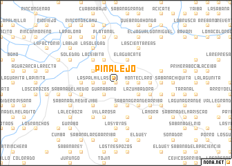
Pinalejo (Sánchez Ramírez, Dominican Republic)Pinalejo is a town in the Sánchez Ramírez region of Dominican Republic. An overview map of the region around Pinalejo is displayed below.
regional and 3d topo map of Pinalejo, Dominican Republic ::
Pinalejo airports ::
The nearest airport is STI - Santiago Cibao Intl, located 66.5 km north west of Pinalejo.
Other airports nearby include SDQ - Santo Domingo Las Americas Intl (83.0 km south east), POP - Puerto Plata Gregorio Luperon Intl (92.0 km north west), LRM - La Romana Casa De Campo Intl (141.1 km south east), BRX - Barahona Maria Montez Intl (141.8 km south west), Nearby towns ::
Saballo (0.0km north) //
El Tope (1.9km north) //
El Aguacatico (1.9km north) //
La Tusa (1.8km east) //
Valle Grande (1.8km west) //
La Vuelta (2.6km north west) //
Guanábano (2.6km south west) //
Monte Claro (3.5km east) //
Las Palmillas (3.5km west) //
Sabana Grande Abajo (3.7km south) //
El Aguacate (4.1km north east) //
Chacuey Abajo (4.1km north west) //
La Zumbadora (4.0km south east) //
Chacuey Abajo (4.0km north west) //
Los Cerros (4.1km south east) //
El Cruce de Vásquez (4.1km south east) //
La Ceibita (5.1km north west) //
El Rancho (5.1km north west) //
Hoyo de Luis (5.1km south east) //
Sabana Grande Arriba (5.1km south east) //
Jibe (5.1km south west) //
La Esperanza (5.3km west) //
El Hato (5.3km west) //
La Trocha (5.3km east) //
El Pelú (5.3km east) //
La Labranza (5.8km south) //
Villa Rosa (5.8km south) //
Colonia Juan Sánchez Ramírez (5.6km west) //
La Colesita Arriba (5.6km east) //
[all distances 'as the bird flies' and approximate] 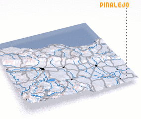 Places with similar names to Pinalejo, Dominican Republic ::
// Pine Lodge (US)
// Pine Lodge (US)
// Pinalejo (MX)
// Pinalejo (HN)
// Pinalejo (HN)
// Pine Lodge (AU)
Disclaimer :: Information on this page comes without warranty of any kind |
||
|
Where is Pinalejo? Elevation and coordinates ::
Latitude (lat): 19°4'0"N Longitude (lon): 70°5'0"W
Elevation (approx.): 48m (map arrows pan, magnifying glasses zoom) |
||
|
Visiting Pinalejo? Hotel/Accommodation ::
Book a hotel in Pinalejo Travel Guide ::
rental cars ::
car rental offers GPS waypoint ::
download a GPX waypoint (PoI) of Pinalejo for your GPS receiver
|
||