|
search place name
|
||
Pinalito (La Vega, Dominican Republic)Pinalito is a town in the La Vega region of Dominican Republic. An overview map of the region around Pinalito is displayed below.
regional and 3d topo map of Pinalito, Dominican Republic ::

Pinalito airports ::
The nearest airport is STI - Santiago Cibao Intl, located 54.3 km north of Pinalito.
Other airports nearby include BRX - Barahona Maria Montez Intl (89.8 km south west), POP - Puerto Plata Gregorio Luperon Intl (93.4 km north), SDQ - Santo Domingo Las Americas Intl (115.1 km south east), PAP - Port-au-prince Toussaint Louverture Intl (178.9 km west), Nearby towns ::
La Novilla (1.8km west) //
El Naranjo (2.6km south east) //
Palerito (3.5km west) //
La Unión (3.7km south) //
La Pelá (4.1km north east) //
Los Sánchez (4.1km north west) //
Tireo Abajo (4.0km north west) //
El Mansito (4.0km south west) //
Las Nueces (5.1km north east) //
La Vaca Blanca (5.1km north west) //
Los Mañanguises (5.1km south west) //
La Cumbre (5.6km north) //
Tireo Arriba (5.6km west) //
Tireo al Medio (5.6km west) //
La Cerca (5.6km west) //
El Alto de los Pinos (5.8km north) //
Los Magueyes (5.6km west) //
El Pomito (5.8km north) //
Chicharrón (6.4km north west) //
El Haití (6.4km north west) //
Arenosito (6.6km north east) //
La Cotorra (6.6km north west) //
Los Amaceyes (6.4km south east) //
El Río (7.4km north) //
El Gajo del Mulo (7.3km west) //
Cerro de Monte (7.3km west) //
La Sabina (7.3km west) //
Los Higos (7.3km west) //
Palero (7.3km west) //
[all distances 'as the bird flies' and approximate] 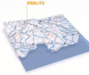 Places with similar names to Pinalito, Dominican Republic ::
// Panhla Te (MM)
// Penna Alta (IT)
// Pianelleto (IT)
// Pinalito (CU)
// Peñolite (ES)
// Piñalito (CO)
// Piñalito (CO)
// Piñalito (CO)
// Piñalito (CO)
// Piñalito (CO)
Disclaimer :: Information on this page comes without warranty of any kind |
||
|
Where is Pinalito? Elevation and coordinates ::
Latitude (lat): 18°55'0"N Longitude (lon): 70°38'0"W
Elevation (approx.): 1290m (map arrows pan, magnifying glasses zoom) |
||
|
Visiting Pinalito? Hotel/Accommodation ::
Book a hotel in Pinalito Travel Guide ::
rental cars ::
car rental offers GPS waypoint ::
download a GPX waypoint (PoI) of Pinalito for your GPS receiver
|
||