|
search place name
|
||
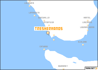
Tres Hermanos (La Altagracia, Dominican Republic)Tres Hermanos is a town in the La Altagracia region of Dominican Republic. An overview map of the region around Tres Hermanos is displayed below.
regional and 3d topo map of Tres Hermanos, Dominican Republic ::
Tres Hermanos airports ::
The nearest airport is LRM - La Romana Casa De Campo Intl, located 27.0 km north west of Tres Hermanos.
Other airports nearby include PUJ - Punta Cana Intl (55.2 km north east), SDQ - Santo Domingo Las Americas Intl (97.4 km west), MAZ - Mayaguez Eugenio Maria De Hostos (171.1 km east), BQN - Aguadilla Rafael Hernandez (175.1 km east), Nearby towns ::
Las Palmillas (1.8km east) //
Palma Seca (2.6km south east) //
La Tortuga (3.7km north) //
Guazumilla (5.8km north) //
Catuano (5.8km south) //
Guaraguao (5.8km north) //
La Fragata (9.1km north west) //
[all distances 'as the bird flies' and approximate] 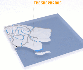 Places with similar names to Tres Hermanos, Dominican Republic ::
// Tres Hermanos (BO)
// Tres Hermanos (BO)
// Tres Hermanas (PA)
// Tres Hermanas (CU)
// Tres Hermanas (CU)
// Tres Hermanos (CU)
// Tres Hermanos (CO)
// Tres Hermanos (CR)
// Tres Hermanas (EC)
// Tres Hermanas (EC)
Disclaimer :: Information on this page comes without warranty of any kind |
||
|
Where is Tres Hermanos? Elevation and coordinates ::
Latitude (lat): 18°15'0"N Longitude (lon): 68°46'0"W
Elevation (approx.): 1m (map arrows pan, magnifying glasses zoom) |
||
|
Visiting Tres Hermanos? Hotel/Accommodation ::
Book a hotel in Tres Hermanos Travel Guide ::
rental cars ::
car rental offers GPS waypoint ::
download a GPX waypoint (PoI) of Tres Hermanos for your GPS receiver
|
||