|
search place name
|
||
Kamenʼchany (Belarus)Kamenʼchany is a town in Belarus. An overview map of the region around Kamenʼchany is displayed below.
regional and 3d topo map of Kamenʼchany, Belarus ::
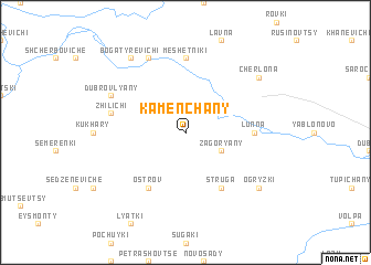
Nearby towns ::
Podbozhany (2.2km north east) //
Zagoryany (2.9km south east) //
Struga (6.0km south) //
Ostrov (6.0km south) //
Lunna (4.1km east) //
Meshetniki (7.4km north) //
Zhilichi (4.8km north west) //
Dubrovlyany (5.8km north west) //
Kovshovo (7.7km north) //
Cherlona (7.1km north east) //
Ogryzki (7.1km south east) //
Bogatyrevichi (8.1km north west) //
[all distances 'as the bird flies' and approximate] 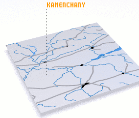 Places with similar names to Kamenʼchany, Belarus ::
// Caminchen (DE)
// Kombeni Chuuni (TZ)
// Commenchon (FR)
// Kuman-ch'on (KP)
// Gumnichina (BY)
// Kamenchany (BY)
Disclaimer :: Information on this page comes without warranty of any kind |
||
|
Where is Kamenʼchany? Elevation and coordinates ::
Latitude (lat): 53°27'0"N Longitude (lon): 24°13'0"E
Elevation (approx.): 113m (map arrows pan, magnifying glasses zoom) |
||
|
Visiting Kamenʼchany? Hotel/Accommodation ::
Book a hotel in Kamenʼchany Travel Guide ::
Buy a travel guide for Belarus rental cars ::
car rental offers GPS waypoint ::
download a GPX waypoint (PoI) of Kamenʼchany for your GPS receiver
|
||