|
search place name
|
||
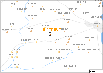
Kletnoye (Mahilyowskaya Voblastsʼ, Belarus)Kletnoye is a town in the Mahilyowskaya Voblastsʼ region of Belarus. An overview map of the region around Kletnoye is displayed below.
regional and 3d topo map of Kletnoye, Belarus ::
Kletnoye airports ::
The nearest airport is GME - Gomel, located 123.2 km south east of Kletnoye.
Other airports nearby include VTB - Vitebsk (183.6 km north), Nearby towns ::
Vygoda (2.2km south east) //
Penyugi (3.3km north west) //
Yamnoye (3.3km north east) //
Vʼyun (3.8km south west) //
Podlesnyy (4.3km south east) //
Novaya Boyarshchina (5.8km south) //
Lagoda (3.8km east) //
Staraya Boyarshchina (4.1km south east) //
Seliba (4.9km north west) //
Khutor (6.5km north east) //
Guta Romakovskaya (8.8km south) //
Kholostovo (8.3km north) //
Gorodets (8.1km north west) //
[all distances 'as the bird flies' and approximate] 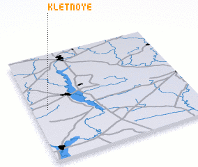 Places with similar names to Kletnoye, Belarus ::
Disclaimer :: Information on this page comes without warranty of any kind |
||
|
Where is Kletnoye? Elevation and coordinates ::
Latitude (lat): 53°29'3"N Longitude (lon): 30°5'45"E
Elevation (approx.): 153m (map arrows pan, magnifying glasses zoom) |
||
|
Visiting Kletnoye? Hotel/Accommodation ::
Book a hotel in Kletnoye Travel Guide ::
Buy a travel guide for Belarus rental cars ::
car rental offers GPS waypoint ::
download a GPX waypoint (PoI) of Kletnoye for your GPS receiver
|
||