|
search place name
|
||
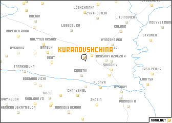
Kuranovshchina (Belarus)Kuranovshchina is a town in Belarus. An overview map of the region around Kuranovshchina is displayed below.
regional and 3d topo map of Kuranovshchina, Belarus ::
Kuranovshchina airports ::
The nearest airport is GME - Gomel, located 67.5 km south of Kuranovshchina.
Nearby towns ::
Karma (1.5km north east) //
Masterovaya Slobodka (1.9km north) //
Korotʼki (3.1km south) //
Novaya Slobodka (2.9km north east) //
Kalinin (2.6km east) //
Krasnaya Zvezda (3.3km east) //
Krasnaya Vetka (3.3km east) //
Novaya Khalapovka (5.6km south) //
Shirokiy (3.8km south east) //
Sapozhki (4.3km south east) //
Rudnya (6.0km south) //
Vynoshevka (5.0km north east) //
Reut (4.4km west) //
Novosëlki (4.4km west) //
Lebedevka (7.0km north) //
Bolʼshiye Barsuki (4.8km north west) //
Chamyshelʼ (7.5km south) //
Barsuki (5.4km west) //
Bobnov (8.1km south west) //
Kalinin (8.0km north east) //
Vysokiy (8.1km south east) //
Krasnyy (9.1km south east) //
Rozov (9.3km south west) //
[all distances 'as the bird flies' and approximate] 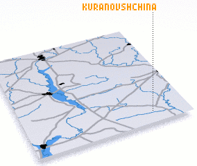 Places with similar names to Kuranovshchina, Belarus ::
Disclaimer :: Information on this page comes without warranty of any kind |
||
|
Where is Kuranovshchina? Elevation and coordinates ::
Latitude (lat): 53°7'0"N Longitude (lon): 30°47'0"E
Elevation (approx.): 152m (map arrows pan, magnifying glasses zoom) |
||
|
Visiting Kuranovshchina? Hotel/Accommodation ::
Book a hotel in Kuranovshchina Travel Guide ::
Buy a travel guide for Belarus rental cars ::
car rental offers GPS waypoint ::
download a GPX waypoint (PoI) of Kuranovshchina for your GPS receiver
|
||