|
search place name
|
||
Nekhvedy (Belarus)Nekhvedy is a town in Belarus. An overview map of the region around Nekhvedy is displayed below.
regional and 3d topo map of Nekhvedy, Belarus ::

Nekhvedy airports ::
The nearest airport is MHP - Minsk 1, located 107.2 km south east of Nekhvedy.
Other airports nearby include MSQ - Minsk 2 (127.7 km south east), Nearby towns ::
Leshchenyaty (1.9km south) //
Spyaglitsa (1.9km north) //
Eytsvily (2.1km west) //
Telyaki (2.8km south east) //
Svinka (2.8km north west) //
Dubatovka (4.3km south west) //
Osinuvka (5.7km north) //
Kruni (6.0km south) //
Abramovshchina (4.7km south east) //
Raslo (5.7km south west) //
Lokachi (5.7km south east) //
Voystom (8.6km south east) //
Postazhyne Vtoroye (8.6km north west) //
[all distances 'as the bird flies' and approximate] 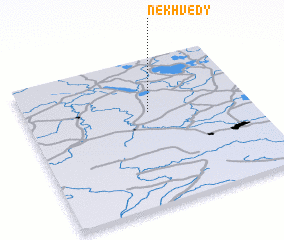 Places with similar names to Nekhvedy, Belarus ::
// Ngaiphaite (MM)
// Ngaphedu (MM)
// Ngouvota (CF)
// Ngouvota (CF)
// Nāgavedu (IN)
// Naki Fada (NE)
// Nakifada (NE)
// Ngoufat (SN)
// Nikka Phattu (PK)
// Nagofita (NG)
Disclaimer :: Information on this page comes without warranty of any kind |
||
|
Where is Nekhvedy? Elevation and coordinates ::
Latitude (lat): 54°38'0"N Longitude (lon): 26°33'0"E
Elevation (approx.): 164m (map arrows pan, magnifying glasses zoom) |
||
|
Visiting Nekhvedy? Hotel/Accommodation ::
Book a hotel in Nekhvedy Travel Guide ::
Buy a travel guide for Belarus rental cars ::
car rental offers GPS waypoint ::
download a GPX waypoint (PoI) of Nekhvedy for your GPS receiver
|
||